Toggle navigation
LMEC Home
Exhibitions
Georeferencing
Tools for Teachers
Collections
My Favorites
Sign Up / Log In
Search
Search the map portal
Map Collection
Map Collection
Map Sets
Search
Search
Search for
Search In
All Fields
Creator
Title
Subject
Place
Search All Digital Collections
Advanced Search
8803 Results
My Search
Start Over
More Like
commonwealth:4m90fd76c
Remove constraint More Like: commonwealth:4m90fd76c
Filter your Search
Place
North and Central America
6,034
United States
4,938
Massachusetts
2,155
Europe
1,396
Suffolk (county)
1,049
Boston
1,022
Canada
456
Asia
438
more
Place
»
Topic
Boston (Mass.)--Maps
592
United States--Maps
282
Massachusetts--Maps
235
Real property--Massachusetts--Boston--Maps
175
Landowners--Massachusetts--Boston--Maps
133
New England--Maps
127
North America--Maps--Early works to 1800
103
Europe--Maps
79
more
Topic
»
Date
Date range begin
–
Date range end
Current results range from
1482
to
2023
View distribution
Creator
United States. Hydrographic Office
595
O.H. Bailey & Co
148
Des Barres, Joseph F. W. (Joseph Frederick Wallet), 1722-1824
123
United States. Post Office Dept
120
Ptolemy, 2nd cent
100
Walling, Henry Francis, 1825-1888
95
Geological Survey (U.S.)
93
Jefferys, Thomas, -1771
86
more
Creator
»
Format
Maps/Atlases
8,742
Manuscripts
217
Prints
56
Books
36
Objects/Artifacts
10
Drawings/Illustrations
8
Posters
5
Ephemera
1
Georeferenced
Yes
881
No
7,922
Collection
Norman B. Leventhal Map & Education Center Collection
8,742
Boston and New England Maps
2,286
Urban Maps
2,024
Maritime Charts and Atlases
1,083
American Revolutionary War-Era Maps
660
Boston Redevelopment Authority Collection
90
David Judkins Weaver Papers
23
Applied Geographics, Inc. Records
20
more
Collection
»
Available to use
No known restrictions
8,600
Creative Commons license
54
Search Constraints
Sort by relevance
relevance
title
date (asc)
date (desc)
Number of results to display per page
20 per page
10
per page
20
per page
50
per page
100
per page
View results as:
grid view
map view
Search Results
2501.
The empire of Germany with the 13 cantons of Switzerland from the best authorities
2502.
Encampment of First Brigade, Maine Volunteer Militia, Augusta, Aug.25, 26, 27, 28, 1885
2503.
Endermo Harbor, Island of Jesso
2504.
England
2505.
England and Wales
2506.
England and Wales accurately delineated from the latest surveys
2507.
England--south coast, approaches to Falmouth : republished from the British Admiralty chart of 1872
2508.
England--south coast, Portland Harbor : republished from British Admy. chart no. 2268
2509.
The English Empire in America, Newfound-land, Canada, Hudsons Bay &c. in plano
2510.
The English empire in America, Newfound-land, Canada, Hudsons Bay, &c. in plano
2511.
Enosburg Falls, Vt : Franklin Co., 1892
2512.
Ensaio de carta geral das Bandeiras Paulistas : seculos XVI-XVII-XVIII
2513.
Environs de Leogane et du Port Au Prince dans l'Isle de St. Domingue
2514.
Environs de Paris
2515.
Environs de Quebec : bloque par les Americains du 8. decembre 1775 au 13. mai 1776
2516.
Environs of Boston, from Corey's Hill, Brookline, Mass
2517.
Environs of Dartmoor : compiled for the autumn manœuvers (south division), showing the various encampments, and divided into...
2518.
The environs of Dublin
2519.
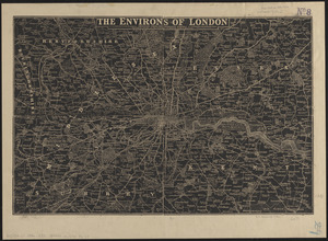
The environs of London : reduced from the Ordnance Survey
2520.
[Environs of Philadelphia]
‹ Prev
Next ›
1
2
…
122
123
124
125
126
127
128
129
130
…
440
441


![[Environs of Philadelphia]](https://bpldcassets.blob.core.windows.net/derivatives/images/commonwealth:7h149x76d/image_thumbnail_300.jpg)