Toggle navigation
LMEC Home
Exhibitions
Georeferencing
Tools for Teachers
Collections
My Favorites
Sign Up / Log In
Search
Search the map portal
Map Collection
Map Collection
Map Sets
Search
Search
Search for
Search In
All Fields
Creator
Title
Subject
Place
Search All Digital Collections
Advanced Search
8710 Results
My Search
Start Over
More Like
commonwealth:4m90fd108
Remove constraint More Like: commonwealth:4m90fd108
Filter your Search
Place
North and Central America
5,941
United States
4,859
Massachusetts
2,079
Europe
1,396
Suffolk (county)
1,046
Boston
1,019
Canada
449
Asia
438
more
Place
»
Topic
Boston (Mass.)--Maps
586
United States--Maps
282
Real property--Massachusetts--Boston--Maps
175
Massachusetts--Maps
162
Landowners--Massachusetts--Boston--Maps
133
North America--Maps--Early works to 1800
103
New England--Maps
102
Europe--Maps
79
more
Topic
»
Date
Date range begin
–
Date range end
Current results range from
1482
to
2023
View distribution
Creator
United States. Hydrographic Office
595
O.H. Bailey & Co
148
Des Barres, Joseph F. W. (Joseph Frederick Wallet), 1722-1824
123
United States. Post Office Dept
120
Ptolemy, 2nd cent
100
Walling, Henry Francis, 1825-1888
94
Geological Survey (U.S.)
86
Jefferys, Thomas, -1771
85
more
Creator
»
Format
Maps/Atlases
8,650
Manuscripts
220
Prints
56
Books
36
Objects/Artifacts
10
Drawings/Illustrations
8
Posters
5
Georeferenced
Yes
870
No
7,840
Collection
Norman B. Leventhal Map & Education Center Collection
8,694
Boston and New England Maps
2,233
Urban Maps
2,023
Maritime Charts and Atlases
1,083
American Revolutionary War-Era Maps
632
Boston Redevelopment Authority Collection
87
Library of Congress Collection
4
MacLean Collection Map Library
4
more
Collection
»
Available to use
No known restrictions
8,552
Creative Commons license
59
Search Constraints
Sort by relevance
relevance
title
date (asc)
date (desc)
Number of results to display per page
20 per page
10
per page
20
per page
50
per page
100
per page
View results as:
grid view
map view
Search Results
1.
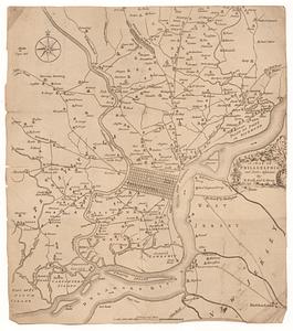
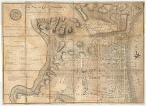
[Environs of Philadelphia]
2.
Grundriss von Philadelphia der hauptstadt in Pensylvanien und umliegenden Gegend
3.
A mapp of ye improved part of Pensilvania in America, divided into countyes, townships, and lotts
4.
A plan of the city and environs of Philadelphia
5.
A plan of the city of Philadelphia, the capital of Pennsylvania, from an actual survey
6.
A map of Philadelphia and parts adjacent
7.
A map of Philadelphia and parts adjacent
8.
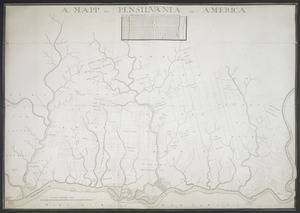
A MAPP OF PENSYLVANIA IN AMERICA
9.
Philadelphia and neighborhood
10.
Philadelphia and vicinity. Military
11.
Philadelphie, par Easburn, arpenteur general de Pensilvanie
12.
A plan of the city and environs of Philadelphia
13.
Plan of the city of Philadelphia
14.
A plan of the city of Philadelphia
15.
Plan of the city of Philadelphia and its environs shewing its defences during the years 1777 & 1778 : together with the siege...
16.
A plan of the city of Philadelphia, the capital of Pennsylvania, from an actual survey
17.
A plan of the city of Philadelphia, the capital of Pennsylvania, from an actual survey
18.
A plan of the operations of the British & Rebel army in the Campaign, 1777
19.
Theatre des operations des armees Americaine et Britanique en 1776 et 1777, depuis la Riviere de Rariton, dans le Jersey de...
20.
This plan of the city of Philadelphia and its environs, (shewing the improved parts,) is dedicated to the mayor, aldermen and...
‹ Prev
Next ›
1
2
3
4
5
…
435
436
![[Environs of Philadelphia]](https://bpldcassets.blob.core.windows.net/derivatives/images/commonwealth:7h149x76d/image_thumbnail_300.jpg)