Toggle navigation
LMEC Home
Exhibitions
Georeferencing
Tools for Teachers
Collections
My Favorites
Sign Up / Log In
Search
Search the map portal
Map Collection
Map Collection
Map Sets
Search
Search
Search for
Search In
All Fields
Creator
Title
Subject
Place
Search All Digital Collections
Advanced Search
8720 Results
My Search
Start Over
More Like
commonwealth:4m90f3383
Remove constraint More Like: commonwealth:4m90f3383
Filter your Search
Place
North and Central America
5,951
United States
4,869
Massachusetts
2,079
Europe
1,396
Suffolk (county)
1,046
Boston
1,019
Canada
449
Asia
438
more
Place
»
Topic
Boston (Mass.)--Maps
586
United States--Maps
282
Real property--Massachusetts--Boston--Maps
175
Massachusetts--Maps
162
Landowners--Massachusetts--Boston--Maps
133
North America--Maps--Early works to 1800
103
New England--Maps
102
Europe--Maps
79
more
Topic
»
Date
Date range begin
–
Date range end
Current results range from
1482
to
2023
View distribution
Creator
United States. Hydrographic Office
595
O.H. Bailey & Co
148
Des Barres, Joseph F. W. (Joseph Frederick Wallet), 1722-1824
123
United States. Post Office Dept
120
Ptolemy, 2nd cent
100
Walling, Henry Francis, 1825-1888
94
Geological Survey (U.S.)
86
Jefferys, Thomas, -1771
85
more
Creator
»
Format
Maps/Atlases
8,660
Manuscripts
216
Prints
56
Books
36
Objects/Artifacts
10
Drawings/Illustrations
8
Posters
5
Georeferenced
Yes
869
No
7,851
Collection
Norman B. Leventhal Map & Education Center Collection
8,694
Boston and New England Maps
2,233
Urban Maps
2,023
Maritime Charts and Atlases
1,083
American Revolutionary War-Era Maps
641
Boston Redevelopment Authority Collection
87
William L. Clements Library Collection
21
New-York Historical Society Collection
3
more
Collection
»
Available to use
No known restrictions
8,555
Creative Commons license
49
Search Constraints
Sort by relevance
relevance
title
date (asc)
date (desc)
Number of results to display per page
20 per page
10
per page
20
per page
50
per page
100
per page
View results as:
grid view
map view
Search Results
1.
The strangers mercantile guide map of the cities of New York, Brooklyn, Jersey City, Hoboken, etc
2.
Map of New-York
3.
Map of New York and vicinity
4.
Rand McNally & Co.'s map of the southern portion of New York City ; Rand McNally & Co.'s map of the main portion of Brooklyn
5.
Map of New York and vicinity
6.
Rand McNally & Co.'s map of New York City, Brooklyn, Jersey City and vicinity
7.
New map of New York City : from the latest authentic surveys, showing all ferries, and all steamship docks both foreign and...
8.
New York City : (southern part)
9.
City of New-York
10.
Map of the cities of New York, Brooklyn & Jersey City
11.
Hammond's complete map of Jersey City, Bayonne and Hoboken
12.
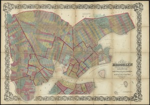
Map of the City of Brooklyn as consolidated by an act of the legislature of the State of New York : including Brooklyn,...
13.
Map of northern part of New York City
14.
Plan of the city of New-York
15.
A plan of the City of New York from an actual survey anno domini MDCCLV
16.
The Firemen's guide : a map of the City of New-York, showing the fire districts, fire limits, hydrants, public cisterns,...
17.
Hagstrom's map of Brooklyn (New York City) : house-number and subway guide
18.
Map of the State of New-York exhibiting the several towns and counties together with the population as determined by the census...
19.
Center of New York, first city of the world
20.
Citizens & travelers guide map in, to and from the city of New York and adjacent places
‹ Prev
Next ›
1
2
3
4
5
…
435
436