Toggle navigation
LMEC Home
Exhibitions
Georeferencing
Tools for Teachers
Collections
My Favorites
Sign Up / Log In
Search
Search the map portal
Map Collection
Map Collection
Map Sets
Search
Search
Search for
Search In
All Fields
Creator
Title
Subject
Place
Search All Digital Collections
Advanced Search
8840 Results
My Search
Start Over
More Like
commonwealth:4742dg72h
Remove constraint More Like: commonwealth:4742dg72h
Filter your Search
Place
North and Central America
6,071
United States
4,989
Massachusetts
2,124
Europe
1,396
Suffolk (county)
1,191
Boston
1,164
Canada
449
Asia
438
more
Place
»
Topic
Boston (Mass.)--Maps
619
United States--Maps
282
Real property--Massachusetts--Boston--Maps
220
City planning--Massachusetts--Boston--Maps
168
Landowners--Massachusetts--Boston--Maps
168
Massachusetts--Maps
162
Buildings--Massachusetts--Boston--Maps
125
North America--Maps--Early works to 1800
103
more
Topic
»
Date
Date range begin
–
Date range end
Current results range from
1482
to
2023
View distribution
Creator
United States. Hydrographic Office
595
Boston Redevelopment Authority
165
O.H. Bailey & Co
148
Des Barres, Joseph F. W. (Joseph Frederick Wallet), 1722-1824
123
United States. Post Office Dept
120
Ptolemy, 2nd cent
100
Walling, Henry Francis, 1825-1888
94
Geological Survey (U.S.)
86
more
Creator
»
Format
Maps/Atlases
8,779
Manuscripts
215
Prints
56
Books
36
Objects/Artifacts
10
Drawings/Illustrations
9
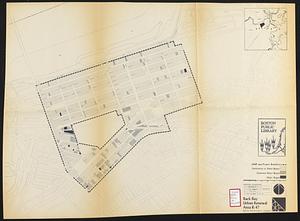
Posters
5
Georeferenced
Yes
871
No
7,969
Collection
Norman B. Leventhal Map & Education Center Collection
8,700
Boston and New England Maps
2,340
Urban Maps
2,129
Maritime Charts and Atlases
1,083
American Revolutionary War-Era Maps
620
Boston Redevelopment Authority Collection
189
Massachusetts Real Estate Atlases
34
Mapping Boston Collection
3
more
Collection
»
Available to use
No known restrictions
8,658
Creative Commons license
50
Search Constraints
Sort by relevance
relevance
title
date (asc)
date (desc)
Number of results to display per page
20 per page
10
per page
20
per page
50
per page
100
per page
View results as:
grid view
map view
Search Results
101.
Atlas of the city of Boston : Dorchester
102.
Atlas of the city of Boston : Roxbury
103.
Atlas of the city of Boston : wards 25 and 26, Brighton
104.
Atlas of the city of Boston : Boston proper and Back Bay
105.
Atlas of the city of Boston : Boston proper and Back Bay
106.
Atlas of the county of Suffolk, Massachusetts, vol. 1 : including Boston proper
107.
Atlas of the county of Suffolk, Massachusetts, vol. 2 : late city of Roxbury, now wards 13-14 and 15, city of Boston
108.
Atlas of the county of Suffolk, Massachusetts, vol. 3 : including South Boston and Dorchester
109.
Atlas of the county of Suffolk, Massachusetts, vol. 4 : including East Boston, city of Chelsea, Revere and Winthrop
110.
Atlas of the county of Suffolk, Massachusetts, vol. 5 : West Roxbury, now ward 17, Boston
111.
Atlas of the county of Suffolk, Massachusetts, vol. 7 : late town of Brighton, now ward 19 of Boston, Massachusetts
112.
Back Bay study
113.
Back Bay urban renewal area r-47 : land use plan
114.
Back Bay urban renewal area r-47 : building conditions
115.
Back Bay urban renewal area r-47 : building conditions
116.
Back Bay urban renewal area r-47 : building conditions
117.
Basement plan of terminal station at Boston, Massachusetts, for the N.Y.N.H & H. and B. & A. railroads
118.
Boston proper
119.
Boston University, Charles River campus master plan
120.
Campus High School urban renewal area Mass. r- : building conditions
‹ Prev
Next ›
1
2
3
4
5
6
7
8
9
10
…
441
442