Toggle navigation
LMEC Home
Exhibitions
Georeferencing
Tools for Teachers
Collections
My Favorites
Sign Up / Log In
Search
Search the map portal
Map Collection
Map Collection
Map Sets
Search
Search
Search for
Search In
All Fields
Creator
Title
Subject
Place
Search All Digital Collections
Advanced Search
8889 Results
My Search
Start Over
More Like
commonwealth:3f4636930
Remove constraint More Like: commonwealth:3f4636930
Filter your Search
Place
North and Central America
6,120
United States
5,036
Massachusetts
2,135
Europe
1,396
Suffolk (county)
1,235
Boston
1,208
Canada
449
Asia
438
more
Place
»
Topic
Boston (Mass.)--Maps
752
United States--Maps
282
Real property--Massachusetts--Boston--Maps
223
Landowners--Massachusetts--Boston--Maps
169
Massachusetts--Maps
166
City planning--Massachusetts--Boston--Maps
159
New England--Maps
104
North America--Maps--Early works to 1800
103
more
Topic
»
Date
Date range begin
–
Date range end
Current results range from
1482
to
2023
View distribution
Creator
United States. Hydrographic Office
595
Boston Redevelopment Authority
163
O.H. Bailey & Co
148
Des Barres, Joseph F. W. (Joseph Frederick Wallet), 1722-1824
124
United States. Post Office Dept
120
Ptolemy, 2nd cent
100
Walling, Henry Francis, 1825-1888
94
Geological Survey (U.S.)
87
more
Creator
»
Format
Maps/Atlases
8,829
Manuscripts
215
Prints
56
Books
36
Objects/Artifacts
10
Drawings/Illustrations
8
Posters
5
Georeferenced
Yes
885
No
8,004
Collection
Norman B. Leventhal Map & Education Center Collection
8,723
Boston and New England Maps
2,359
Urban Maps
2,143
Maritime Charts and Atlases
1,083
American Revolutionary War-Era Maps
638
Boston Redevelopment Authority Collection
193
Massachusetts Real Estate Atlases
38
Mapping Boston Collection
20
more
Collection
»
Available to use
No known restrictions
8,666
Creative Commons license
70
Search Constraints
Sort by relevance
relevance
title
date (asc)
date (desc)
Number of results to display per page
20 per page
10
per page
20
per page
50
per page
100
per page
View results as:
grid view
map view
Search Results
6501.
Plan of Framingham Plantation 1699
6502.
Plan of Gregory Farm in Weston
6503.
Plan of Groton Cemetery
6504.
Plan of Groton, Massachusetts : as it was in 1794
6505.
Plan of Guantanimo, called by the English Cumberland Harbor ; Plan of the city and harbour of St. Jago de Cuba
6506.
Plan of Hamburg
6507.
A plan of Hatfield
6508.
Plan of house lots & other lands offered for sale by the Boston Water Power Company
6509.
Plan of house lots at Newton Corner near the residence of Dr. Hitchcock, lately belonging to W.S. Tuckerman
6510.
Plan of house lots at Oak Sq. Brighton : belonging to Oak Sq. Land Trust
6511.
[Plan of house lots for sale on Savin Hill Avenue, Dorchester, Mass.]
6512.
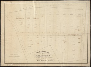
Plan of house lots in Braintree : to be sold at public auction on Saturday May 25th 1850 at 3 o'clock p.m. on the premises
6513.
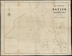
Plan of house lots in Natick belonging to Eben. Whitney : together with a part of Natick Village
6514.
Plan of house lots in the village of Brighton : upon a part of the well known Winship Estate ... to be sold by public auction...
6515.
Plan of house lots in ward 16 : owned by Saml. B. Pierce & Geo. C. Ludington, Boston, near the Dorchester Station, Norfolk...
6516.
Plan of house lots in West Newton, belonging to Chester Judson, to be sold by public auction, on Thursday August 12th at 4...
6517.
Plan of house lots located on Jamaica Plain belonging to the estate of John Dorr, dec'd
6518.
Plan of house lots, Mt. Vernon St., West Roxbury : owned by the Mt. Vernon Land Company, 257 Washington St., Room 3
6519.
[Plan of house lots on Briggs Place, Newton]
6520.
Plan of Humboldt, Humboldt County, Iowa
‹ Prev
Next ›
1
2
…
322
323
324
325
326
327
328
329
330
…
444
445


![[Plan of house lots for sale on Savin Hill Avenue, Dorchester, Mass.]](https://bpldcassets.blob.core.windows.net/derivatives/images/commonwealth:9s161f68b/image_thumbnail_300.jpg)


![[Plan of house lots on Briggs Place, Newton]](https://bpldcassets.blob.core.windows.net/derivatives/images/commonwealth:x059c973z/image_thumbnail_300.jpg)