Toggle navigation
LMEC Home
Exhibitions
Georeferencing
Tools for Teachers
Collections
My Favorites
Sign Up / Log In
Search
Search the map portal
Map Collection
Map Collection
Map Sets
Search
Search
Search for
Search In
All Fields
Creator
Title
Subject
Place
Search All Digital Collections
Advanced Search
8357 Results
My Search
Start Over
More Like
commonwealth:3f463689d
Remove constraint More Like: commonwealth:3f463689d
Filter your Search
Place
North and Central America
5,106
United States
3,794
Suffolk (county)
1,216
Boston
1,189
Europe
963
Canada
427
Massachusetts
275
France
269
more
Place
»
Topic
Boston (Mass.)--Maps
740
United States--Maps
270
Real property--Massachusetts--Boston--Maps
222
Landowners--Massachusetts--Boston--Maps
168
Massachusetts--Maps
163
City planning--Massachusetts--Boston--Maps
156
North America--Maps--Early works to 1800
103
New England--Maps
101
more
Topic
»
Date
Date range begin
–
Date range end
Current results range from
1482
to
2023
View distribution
Creator
United States. Hydrographic Office
357
Boston Redevelopment Authority
161
O.H. Bailey & Co
148
Des Barres, Joseph F. W. (Joseph Frederick Wallet), 1722-1824
124
United States. Post Office Dept
120
Ptolemy, 2nd cent
100
Walling, Henry Francis, 1825-1888
94
Bromley, George Washington
86
more
Creator
»
Format
Maps/Atlases
8,298
Manuscripts
215
Prints
51
Books
36
Objects/Artifacts
10
Drawings/Illustrations
8
Posters
4
Georeferenced
Yes
885
No
7,472
Collection
Norman B. Leventhal Map Center Collection
8,191
Boston and New England Maps
2,310
Urban Maps
2,045
Maritime Charts and Atlases
750
American Revolutionary War-Era Maps
638
Boston Redevelopment Authority Collection
192
Massachusetts Real Estate Atlases
38
Mapping Boston Collection
20
more
Collection
»
Available to use
No known restrictions
8,135
Creative Commons license
69
Search Constraints
Sort by date (desc)
relevance
title
date (asc)
date (desc)
Number of results to display per page
20 per page
10
per page
20
per page
50
per page
100
per page
View results as:
grid view
map view
Search Results
7641.
Ambivareti in Aeduis, ubi postea Vadicasses : Evesché de Nevers
7642.
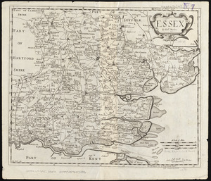
Essex
7643.
L'Evesché de Chartres dìvìsee en archìdìaconéz et doyennéz
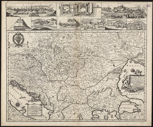
7644.
A new generall map of the seat of war from Vpper Hungary to the Isle of Candia : with exact prospects of Napoli di Romania,...
7645.
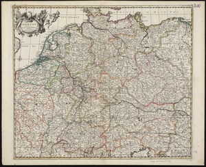
A new map of Germany divided into its general and perticuler parts
7646.
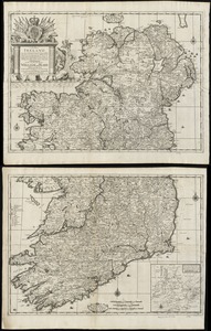
A new map of Ireland according to Sr. W. Petty (but supplied wth. many additions which are not in his survey nor in any other...
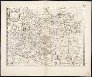
7647.
A new map of Russia or Moscovie divided into its Kingdoms, Dukedoms, Principalities, Provinces, &c
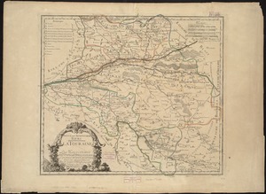
7648.
A new mapp of the Kingdom of Hungary and the states that have been subject to it, which are at present the northern parts of...
7649.
Nouus planiglobii terrestris per utrumque polum conspectus
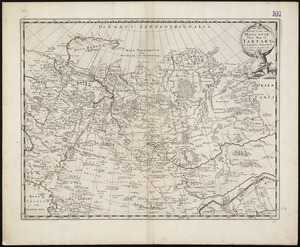
7650.
To the Great Czar of Moscovie this Map of Tartary &c. is humbly dedicated
7651.
Amerique septentrionale divisée en ses principale parties
7652.
Diocese de l'archevesché de Tours : La Touraine : Les Eslections de Tours, d'Amboise, de Loches, et de Chinon
7653.
A draught of Boston Harbor by Capt. Cyprian Southake
7654.
Carte de la mer d'Ecosse contenant les isles et costes septentrionales et occidentales d'Ecosse et les costes septentrionales...
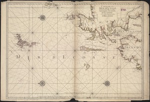
7655.
Citta di Venezia
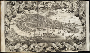
7656.
Insulæ Americanæ in Oceano Septentrionali ac regiones adiacentes : a C. de May usque ad Lineam Æquinoctialem
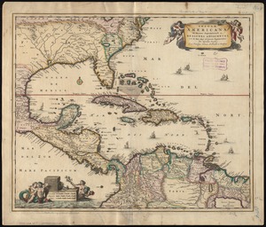
7657.
A map of Canaan : with the adjacent countrie's very usefull for the understanding of the Old Testament
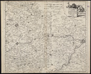
7658.
A new mapp of ye seat of the warr in the counties of Namur and Hainault wherin perticulerly is described ye cittyes town's...
7659.
Ævi veteris usque ad annum salutis nonagesimum supra milles quadringentos cogniti tantum, typus geographica
7660.
America Settentrionale : colle nuove scoperte fin alle' anno 1688 divisa nelle sue partu secondo lo stato presente
‹ Prev
Next ›
1
2
…
379
380
381
382
383
384
385
386
387
…
417
418