Toggle navigation
LMEC Home
Exhibitions
Georeferencing
Tools for Teachers
Collections
My Favorites
Sign Up / Log In
Search
Search the map portal
Map Collection
Map Collection
Map Sets
Search
Search
Search for
Search In
All Fields
Creator
Title
Subject
Place
Search All Digital Collections
Advanced Search
151 Results
My Search
Start Over
More Like
commonwealth:3f462s79h
Remove constraint More Like: commonwealth:3f462s79h
Filter your Search
Place
North and Central America
128
United States
117
Massachusetts
72
Boston
45
Suffolk (county)
44
New England
38
Boston Harbor
28
World
19
more
Place
»
Topic
New England--Maps--Early works to 1800
25
Boston (Mass.)--Maps
20
World maps--Early works to 1800
19
Boston (Mass.)--History--Revolution, 1775-1783--Maps--Early works to 1800
16
Atlantic Coast (New England)--Maps--Early works to 1800
15
Boston Harbor (Mass.)--Maps--Early works to 1800
13
Boston Harbor (Mass.)--Maps
10
Fortification--Massachusetts--Boston--Maps--Early works to 1800
10
more
Topic
»
Date
Date range begin
–
Date range end
Current results range from
1493
to
1927
View distribution
Creator
Page, Thomas Hyde, Sir, 1746-1821
7
Des Barres, Joseph F. W. (Joseph Frederick Wallet), 1722-1824
6
Southack, Cyprian, 1662-1745
6
United States Coast Survey
6
Carleton, Osgood, 1742-1816
5
Bache, A. D. (Alexander Dallas), 1806-1867
4
Bellin, Jacques Nicolas, 1703-1772
4
Faden, William, 1749-1836
3
more
Creator
»
Format
Maps/Atlases
150
Prints
1
Georeferenced
Yes
28
No
123
Collection
Norman B. Leventhal Map & Education Center Collection
150
Mapping Boston Collection
142
Boston and New England Maps
81
American Revolutionary War-Era Maps
42
Maritime Charts and Atlases
36
Urban Maps
24
New York Public Library Collection
1
Available to use
Creative Commons license
138
No known restrictions
13
Search Constraints
Sort by relevance
relevance
title
date (asc)
date (desc)
Number of results to display per page
20 per page
10
per page
20
per page
50
per page
100
per page
View results as:
grid view
map view
Search Results
1.
The coast of Nova Scotia, New England, New-York, Jersey, the Gulph and River of St. Lawrence : the islands of Newfoundland,...
2.
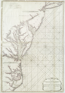
Chart of the coast of New England
3.
The coast of New England
4.
A correct map of the coast of New England
5.
A correct map of the coast of New England
6.
[Globe gore featuring North American coastline]
7.
A new and correct chart of the sea coast of New-England from Cape Codd to Casco Bay
8.
New England : the most remarqueable parts thus named by the high and mighty Prince Charles, prince of great Britaine
9.
A new chart of the coast of North America : from New York to Cape Hatteras, including the bays of Delaware and Chesapeak, with...
10.
Chart from New York to Timber Island including Nantucket Shoals
11.
Chart from New York to Timber Island including Nantucket Shoals
12.
Chart from New York to Timber Island including Nantucket shoals
13.
Chart from New York to Timber Island including Nantucket shoals
14.
A chart of the coast of New England from the South Shoal to Cape Sable including Georges Bay from Holland & actual surveys
15.
The coast of New England
16.
A correct map of the coast of New England
17.
The able doctor; or America swallowing the bitter draught
18.
An accurate map of North America : describing and distinguishing the British and Spanish dominions on this great continent :...
19.
An accurate map of North America : describing and distinguishing the British and Spanish dominions on this great continent :...
20.
An accurate map of the four New England states : shewing in a distinct manner all the mountains, forts, rivers, swamps,...
‹ Prev
Next ›
1
2
3
4
5
…
7
8


![[Globe gore featuring North American coastline]](https://bpldcassets.blob.core.windows.net/derivatives/images/commonwealth:qb98n804g/image_thumbnail_300.jpg)