A correct map of the coast of New England
Item Information
- Title:
- A correct map of the coast of New England
- Description:
-
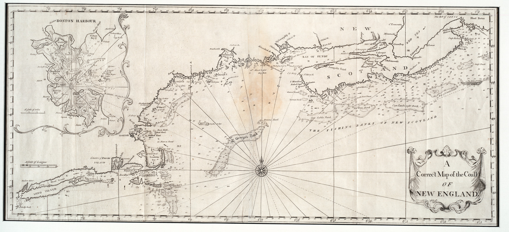
A large fold-out chart of the New England coast appeared from 1732 to 1760 in "The English Pilot, The Fourth Book", the standard 18th-century British navigational guide to American waters. "The English Pilot" a continually updated collection of charts, was published in numerous editions for 100 years beginning in 1689. It was used primarily by American and English captains sailing in the Caribbean waters and along the east coast of North America. Reduced from a chart published in 1729 by Boston ship captain and America's earliest chart maker Cyprian Southack, this particular chart shows the northeastern coast from Long Island to New Scotland (Nova Scotia). It includes an inset of Boston Harbor, one of the few harbor maps published during this period of rapid expansion in Boston.
- Creator:
- Southack, Cyprian, 1662-1745
- Name on Item:
-
[Cyprian Southaick]
- Date:
-
[1737]
- Format:
-
Maps/Atlases
- Location:
- Private Collection
- Collection (local):
-
Mapping Boston Collection
- Subjects:
-
Nautical charts--New England--Early works to 1800
Atlantic Coast (New England)--Maps--Early works to 1800
- Places:
-
New England (area)
- Extent:
- 1 map ; 47 x 107 cm.
- Terms of Use:
-
No known copyright restrictions.
This work is licensed for use under a Creative Commons Attribution Non-Commercial Share Alike License (CC BY-NC-SA).

- Publisher:
-
London :
W. Mount & T. Page
- Scale:
-
Scale not given
- Language:
-
English
- Notes:
-
Appears in English Pilot: 4th book. Dublin. 1730-1762.
Depths shown by soundings.
- Notes (date):
-
This date is inferred.
- Identifier:
-
05_04_000059
- Barcode:
-
39999052509625


