Toggle navigation
LMEC Home
Exhibitions
Georeferencing
Tools for Teachers
Collections
My Favorites
Sign Up / Log In
Search
Search the map portal
Map Collection
Map Collection
Map Sets
Search
Search
Search for
Search In
All Fields
Creator
Title
Subject
Place
Search All Digital Collections
Advanced Search
429 Results
My Search
Start Over
More Like
commonwealth:2v242c61w
Remove constraint More Like: commonwealth:2v242c61w
Filter your Search
Place
North and Central America
380
United States
242
North America
69
Canada
62
New York
49
Pennsylvania
43
New Jersey
20
Asia
17
more
Place
»
Topic
North America--Maps--Early works to 1800
60
United States--Maps--Early works to 1800
43
Canada--Maps--Early works to 1800
38
Pennsylvania--Maps--Early works to 1800
37
New York (State)--Maps--Early works to 1800
34
New Jersey--Maps--Early works to 1800
17
Northeastern States--Maps--Early works to 1800
16
New England--Maps--Early works to 1800
14
more
Topic
»
Date
Date range begin
–
Date range end
Current results range from
1623
to
1999
View distribution
Creator
Jefferys, Thomas, -1771
22
Faden, William, 1749-1836
17
Bellin, Jacques Nicolas, 1703-1772
16
Robert Sayer and John Bennett (Firm)
15
Gibson, J. (John), active 1750-1792
14
Carleton, Osgood, 1742-1816
13
Sayer, Robert, 1725-1794
13
Kitchin, Thomas, 1719-1784
11
more
Creator
»
Format
Maps/Atlases
427
Manuscripts
5
Paintings
3
Ephemera
1
Objects/Artifacts
1
Prints
1
Georeferenced
Yes
4
No
425
Collection
MacLean Collection Map Library
379
American Revolutionary War-Era Maps
371
Norman B. Leventhal Map & Education Center Collection
25
New York Public Library Collection
12
Richard H. Brown Revolutionary War Map Collection at Mount Vernon
8
British Library Collection
2
Mapping Boston Collection
2
Sidney R. Knafel Map Collection at Phillips Academy
2
more
Collection
»
Available to use
Creative Commons license
24
No known restrictions
23
Search Constraints
Sort by relevance
relevance
title
date (asc)
date (desc)
Number of results to display per page
20 per page
10
per page
20
per page
50
per page
100
per page
View results as:
grid view
map view
Search Results
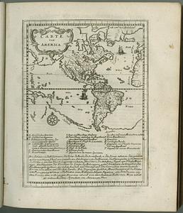
161.
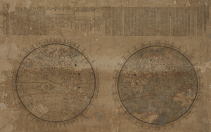
Carte von America
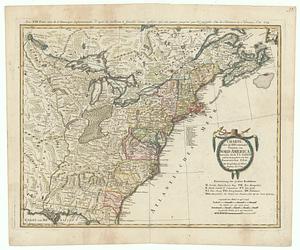
162.
Charte über die XIII Vereinigte Staaten von Nord-America = XIII Etats Unis de I'Amerique Septentrionale, d'apres les meilleures...
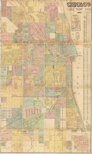
163.
Chicago
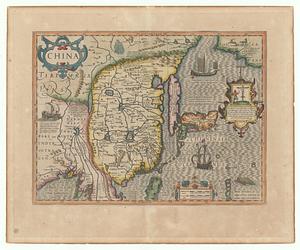
164.
China
165.
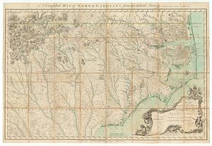
A compleat map of North Carolina from an actual survey
166.
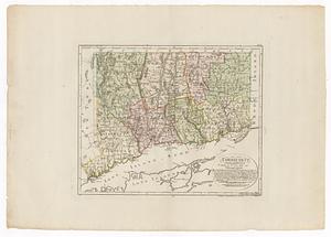
Connecticut
167.
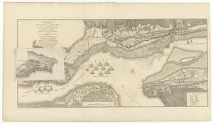
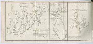
A correct plan of the environs of Quebec, and of the battle fought on the 13.th September, 1759 : together with a particular...
168.
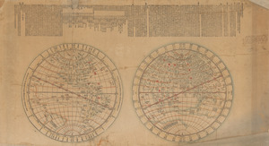
Daqing tong zhigong wanguo jingwei diqiushi fangyu gujin tu
169.
Daqing tong zhigong wanguo jingwei diqiushi fangyu gujin tu
170.
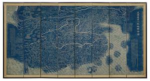
Daqing wannian yitong dili quantu
171.
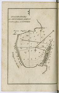
Delineatura del Seno degli Amici l'imboccatura di Nootka
172.
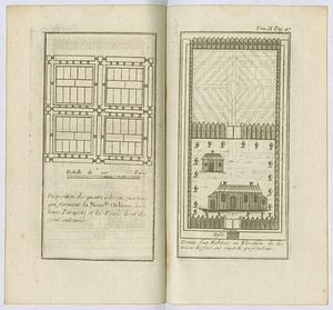
Disposition des quatre isles ou quartiers qui forment la Nouvlle. Orleans avec leurs parapets et les fosses dont its sont...
173.
Dongguk yojido
174.
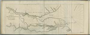
A draught of Nelson & Hayes's Rivers latd. 57°. 10'. north, var. 16°. 45'. westerly
175.
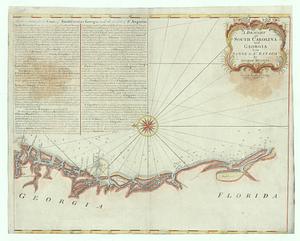
A draught of South Carolina and Georgia from Sewee to St. Estaca
176.
Esquisse des rivieres Muskinghum et Grand Castor que j'ai tiree du journal du General Bouquet, des papiers que m'ont confies...
177.
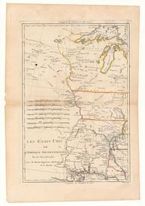
Les Etats Unis de l'Amérique Septentrional partie occidentale ; les Etats Unis de l'Amérique Septentrional partie orientale
178.
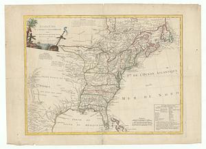
Etats-Unis de l'Amérique Septentrionale avec les Isles Royale, de Terre Neuve, de S.t Jean, l'Acadie, &c.
179.
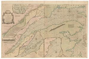
An exact chart of the river S.t Laurence, from Fort Frontenac to the island of Anticosti shewing the soundings, rocks, shoals...
180.
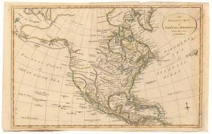
An exact map of North America from the best authorities
‹ Prev
Next ›
1
2
…
5
6
7
8
9
10
11
12
13
…
21
22