Toggle navigation
LMEC Home
Exhibitions
Georeferencing
Tools for Teachers
Collections
My Favorites
Sign Up / Log In
Search
Search the map portal
Map Collection
Map Collection
Map Sets
Search
Search
Search for
Search In
All Fields
Creator
Title
Subject
Place
Search All Digital Collections
Advanced Search
1046 Results
My Search
Start Over
More Like
commonwealth:2801s0605
Remove constraint More Like: commonwealth:2801s0605
Filter your Search
Place
North and Central America
1,042
United States
1,037
Suffolk (county)
1,022
Boston
1,021
Massachusetts
712
Roxbury
53
South End
45
Downtown Boston
40
more
Place
»
Topic
Boston (Mass.)--Maps
752
City planning--Massachusetts--Boston--Maps
366
Urban renewal--Massachusetts--Boston--Maps
234
Real property--Massachusetts--Boston--Maps
131
Land use--Massachusetts--Boston--Maps
99
Buildings--Massachusetts--Boston--Maps
86
Landowners--Massachusetts--Boston--Maps
76
Local transit--Massachusetts--Boston--Maps
57
more
Topic
»
Date
Date range begin
–
Date range end
Current results range from
1743
to
2023
View distribution
Creator
Boston Redevelopment Authority
354
Geo. H. Walker & Co
27
Boynton, George W., d. 1884
21
Sampson, Davenport & Co
21
Sampson, Murdock & Co
20
Bromley, George Washington
18
Bromley, Walter Scott
17
Lufkin, Richard F. (Richard Friend)
17
more
Creator
»
Format
Maps/Atlases
1,046
Manuscripts
9
Prints
1
Georeferenced
Yes
98
No
948
Collection
Boston and New England Maps
866
Urban Maps
768
Norman B. Leventhal Map & Education Center Collection
625
Boston Redevelopment Authority Collection
403
American Revolutionary War-Era Maps
25
Mapping Boston Collection
20
Massachusetts Real Estate Atlases
12
William L. Clements Library Collection
10
more
Collection
»
Available to use
No known restrictions
978
Creative Commons license
34
Search Constraints
Sort by relevance
relevance
title
date (asc)
date (desc)
Number of results to display per page
20 per page
10
per page
20
per page
50
per page
100
per page
View results as:
grid view
map view
Search Results
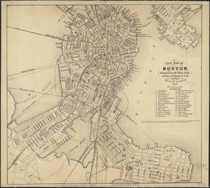
501.
New map of Boston, comprising the whole city, with the new boundaries of the wards
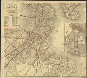
502.
New map of Boston, comprising the whole city, with the new boundaries of the wards
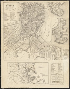
503.
New map of Boston, comprising the whole city, with the new boundaries of the wards
504.
New map of Boston, comprising the whole city, with the new boundaries of the wards
505.
New map of Boston, comprising the whole city, with the new boundaries of the wards
506.
New map of Boston, comprising the whole city, with the new boundaries of the wards
507.
New map of Boston, comprising the whole city with the new boundariess of the wards
508.
New map of Boston from latest surveys
509.
New map of Boston giving all points of interest : with every railway & steamboat terminus, prominent hotels, theatres & public...
510.
New map of Boston giving all points of interest : with every railway & steamboat terminus, prominent hotels, theatres & public...
511.
New map of Boston giving all points of interest : with every railway & steamboat terminus, prominent hotels, theatres & public...
512.
New map of the central portion of Boston
513.
New map of the vicinity of Boston, with the dates of settlement and distance from the capital
514.
New map of the vicinity of Boston, with the dates of settlement and distance from the capital
515.
New map of the vicinity of Boston, with the dates of settlement, population in 1840, and distance from the capital
516.
A new plan of Boston : drawn from the best authorities with the latest improvements, additionas and corrections
517.
A new plan of ye great town of Boston in New England in America with the many additionall buildings & new streets to the year 1743
518.
Official map of Boston
519.
Old Boston, compiled from the Book of possessions
520.
One way streets, metered block faces, parking restriction areas and signal locations within the Boston regional core
‹ Prev
Next ›
1
2
…
22
23
24
25
26
27
28
29
30
…
52
53