Toggle navigation
LMEC Home
Exhibitions
Georeferencing
Tools for Teachers
Collections
My Favorites
Sign Up / Log In
Search
Search the map portal
Map Collection
Map Collection
Map Sets
Search
Search
Search for
Search In
All Fields
Creator
Title
Subject
Place
Search All Digital Collections
Advanced Search
97 Results
My Search
Start Over
More Like
commonwealth:1g05j9964
Remove constraint More Like: commonwealth:1g05j9964
Filter your Search
Place
Canada
76
North and Central America
76
Nova Scotia
35
New France
26
Saint Lawrence River
16
United States
10
Quebec
8
Québec
8
more
Place
»
Topic
Nova Scotia--Maps--Early works to 1800
43
Coasts--Nova Scotia--Maps--Early works to 1800
30
New France--Maps
25
Nautical charts--Nova Scotia--Early works to 1800
24
Seven Years' War, 1756-1763--Campaigns--Canada--Maps
21
Saint Lawrence River--Maps
14
Canada--Maps--Early works to 1800
9
Fortification--Québec (Province)
8
more
Topic
»
Date
Date range begin
–
Date range end
Current results range from
1732
to
1817
View distribution
Creator
Des Barres, Joseph F. W. (Joseph Frederick Wallet), 1722-1824
32
Bellin, Jacques Nicolas, 1703-1772
9
Mackellar, Patrick, 1717-1778
7
Holland, Samuel, 1728-1801
6
Montrésor, John, 1736-1799
5
Collins, John, -1795
3
Duberger, Jean-Baptiste, 1767-1821
3
Gale, Samuel, 1747-1826
3
more
Creator
»
Format
Maps/Atlases
97
Georeferenced
No
97
Collection
American Revolutionary War-Era Maps
92
Library and Archives Canada Collection
52
Norman B. Leventhal Map & Education Center Collection
42
Maritime Charts and Atlases
33
Richard H. Brown Revolutionary War Map Collection at Mount Vernon
2
Boston and New England Maps
1
Harvard Map Collection
1
Mapping Boston Collection
1
Available to use
No known restrictions
41
Creative Commons license
4
Search Constraints
Sort by relevance
relevance
title
date (asc)
date (desc)
Number of results to display per page
20 per page
10
per page
20
per page
50
per page
100
per page
View results as:
grid view
map view
Search Results
21.
Keppell Harbour : Knowles Harbour ; Tangier Harbour ; Saunder's Harbour ; Deane Harbour
22.
King's Bay ... : Lunenburg
23.
Leith Harbour ... : Prospect Harbour ... Bristol Bay ... Sambro Harbour
24.
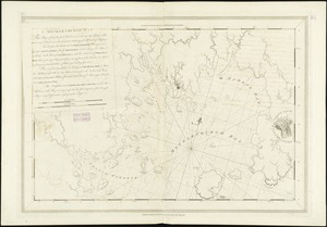
[Lennox Passage region]
25.
Liverpool Bay
26.
Map of Nova Scotia, or Acadia : with the islands of Cape Breton and St. John's, from actual surveys
27.
Map of Nova Scotia, or Acadia : with the islands of Cape Breton and St. John's, from actual surveys
28.
A map of the coast of New England, from Staten Island to the island of Breton
29.
Mecklenburgh Bay
30.
Milford Haven : the head of ye Bay ... boats
31.
New Found Land, St. Laurence Bay, the fishing banks, Acadia, and part of New Scotland
32.
A new map of Nova Scotia and Cape Breton Island : with the adjacent parts of New England and Canada composed from a great...
33.
A new map of Nova Scotia, and Cape Britain : with the adjacent parts of New England and Canada, composed from a great number of...
34.
A new map of Nova Scotia, and Cape Britain : with the adjacent parts of New England and Canada, composed from a great number of...
35.
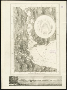
[North east coast of Nova Scotia and Northumberland Strait]
36.
[North east coast of Nova Scotia and Northumberland Strait]
37.
Plans des isles, rades, et ports de plusieurs lieux de l'Amérique : tirés de la Carte angloise de Mr. Popple publiée en 1733...
38.
Port Campbell
39.
Port Hood, situated on the north-western extremity of the island of Cape Breton
40.
Port Mills : Port Mansfield ; Gambier Harbour
‹ Prev
Next ›
1
2
3
4
5


![[Lennox Passage region]](https://bpldcassets.blob.core.windows.net/derivatives/images/commonwealth:ws859h17t/image_thumbnail_300.jpg)


![[North east coast of Nova Scotia and Northumberland Strait]](https://bpldcassets.blob.core.windows.net/derivatives/images/commonwealth:ws859h21d/image_thumbnail_300.jpg)
![[North east coast of Nova Scotia and Northumberland Strait]](https://bpldcassets.blob.core.windows.net/derivatives/images/commonwealth:ws859h23z/image_thumbnail_300.jpg)


