Toggle navigation
LMEC Home
Exhibitions
Georeferencing
Tools for Teachers
Collections
My Favorites
Sign Up / Log In
Search
Search the map portal
Map Collection
Map Collection
Map Sets
Search
Search
Search for
Search In
All Fields
Creator
Title
Subject
Place
Search All Digital Collections
Advanced Search
97 Results
My Search
Start Over
More Like
commonwealth:1g05j9964
Remove constraint More Like: commonwealth:1g05j9964
Filter your Search
Place
Canada
76
North and Central America
76
Nova Scotia
35
New France
26
Saint Lawrence River
16
United States
10
Quebec
8
Québec
8
more
Place
»
Topic
Nova Scotia--Maps--Early works to 1800
43
Coasts--Nova Scotia--Maps--Early works to 1800
30
New France--Maps
25
Nautical charts--Nova Scotia--Early works to 1800
24
Seven Years' War, 1756-1763--Campaigns--Canada--Maps
21
Saint Lawrence River--Maps
14
Canada--Maps--Early works to 1800
9
Fortification--Québec (Province)
8
more
Topic
»
Date
Date range begin
–
Date range end
Current results range from
1732
to
1817
View distribution
Creator
Des Barres, Joseph F. W. (Joseph Frederick Wallet), 1722-1824
32
Bellin, Jacques Nicolas, 1703-1772
9
Mackellar, Patrick, 1717-1778
7
Holland, Samuel, 1728-1801
6
Montrésor, John, 1736-1799
5
Collins, John, -1795
3
Duberger, Jean-Baptiste, 1767-1821
3
Gale, Samuel, 1747-1826
3
more
Creator
»
Format
Maps/Atlases
97
Georeferenced
No
97
Collection
American Revolutionary War-Era Maps
92
Library and Archives Canada Collection
52
Norman B. Leventhal Map & Education Center Collection
42
Maritime Charts and Atlases
33
Richard H. Brown Revolutionary War Map Collection at Mount Vernon
2
Boston and New England Maps
1
Harvard Map Collection
1
Mapping Boston Collection
1
Available to use
No known restrictions
41
Creative Commons license
4
Search Constraints
Sort by relevance
relevance
title
date (asc)
date (desc)
Number of results to display per page
20 per page
10
per page
20
per page
50
per page
100
per page
View results as:
grid view
map view
Search Results
1.
Map showing land grants to the east of St. John
2.
A plan of part of the province of New Brunswick, with the adjacent parts of the province of Lower Canada, and the territory of...
3.
Plan of the city and harbour of St. John in the Province of New Brunswick with a project for its defence, and shewing the...
4.
The harbours of Rishibucto & Buctush : on the west shore of the Gulph of St. Lawrence
5.
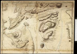
[Port Shediack and Cocagne]
6.
Barrington Bay
7.
Canso Harbor
8.
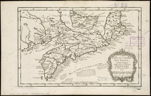
Carte de l'Acadie, Isle Royale, et Païs Voisins : pour servir à l'Histoire Générale des voyages
9.
Charlotte Bay
10.
A chart of Nova Scotia
11.
Coast of Nova Scotia from Barrington Bay to Cape Blancherolte
12.
Coast of Nova Scotia from Barrington Bay to Cape Blancherolte
13.
Conway Harbour : Port Aylesbury
14.
Crow Harbour : on the south shore of Chedabuctou Bay
15.
A draught of the harbour of Hallifax and the adjacent coast in Nova Scotia
16.
Egmont Harbor
17.
Frederick Bay ... : Ramsheg Harbour ... Pictou Harbour ... Port Luttrell
18.
The Gut of Canso : which divides ... cables distance
19.
Halifax Harbour ... Catch Harbour ... small vessels only
20.
Halifax Harbour ... Catch Harbour ... small vessels only
‹ Prev
Next ›
1
2
3
4
5

![[Port Shediack and Cocagne]](https://bpldcassets.blob.core.windows.net/derivatives/images/commonwealth:ws859h35r/image_thumbnail_300.jpg)