Toggle navigation
LMEC Home
Exhibitions
Georeferencing
Tools for Teachers
Collections
My Favorites
Sign Up / Log In
Search
Search the map portal
Map Collection
Map Collection
Map Sets
Search
Search
Search for
Search In
All Fields
Creator
Title
Subject
Place
Search All Digital Collections
Advanced Search
8961 Results
My Search
Start Over
More Like
commonwealth:1257c0839
Remove constraint More Like: commonwealth:1257c0839
Filter your Search
Place
North and Central America
6,192
United States
5,108
Massachusetts
2,167
Europe
1,396
Suffolk (county)
1,307
Boston
1,280
Canada
449
Asia
438
more
Place
»
Topic
Boston (Mass.)--Maps
753
United States--Maps
282
Real property--Massachusetts--Boston--Maps
254
City planning--Massachusetts--Boston--Maps
222
Landowners--Massachusetts--Boston--Maps
170
Massachusetts--Maps
166
Urban renewal--Massachusetts--Boston--Maps
128
New England--Maps
104
more
Topic
»
Date
Date range begin
–
Date range end
Current results range from
1482
to
2023
View distribution
Creator
United States. Hydrographic Office
595
Boston Redevelopment Authority
226
O.H. Bailey & Co
148
Des Barres, Joseph F. W. (Joseph Frederick Wallet), 1722-1824
124
United States. Post Office Dept
120
Ptolemy, 2nd cent
100
Walling, Henry Francis, 1825-1888
94
Geological Survey (U.S.)
87
more
Creator
»
Format
Maps/Atlases
8,900
Manuscripts
215
Prints
56
Books
36
Objects/Artifacts
10
Drawings/Illustrations
9
Posters
5
Georeferenced
Yes
885
No
8,076
Collection
Norman B. Leventhal Map & Education Center Collection
8,726
Boston and New England Maps
2,428
Urban Maps
2,211
Maritime Charts and Atlases
1,083
American Revolutionary War-Era Maps
642
Boston Redevelopment Authority Collection
259
Massachusetts Real Estate Atlases
38
Mapping Boston Collection
21
more
Collection
»
Available to use
No known restrictions
8,734
Creative Commons license
71
Search Constraints
Sort by relevance
relevance
title
date (asc)
date (desc)
Number of results to display per page
20 per page
10
per page
20
per page
50
per page
100
per page
View results as:
grid view
map view
Search Results
781.
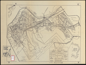
Zoning districts city of Boston map 3 East Boston
782.
Charlestown, Breed's Hill, and Bunker Hill
783.
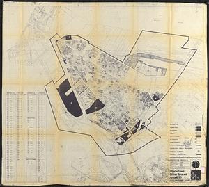
Charlestown project no. Mass r-42 (GN) : existing circulation
784.
Charlestown project no. Mass r-42 (GN) : existing zoning
785.
Charlestown project no. Mass r-42 (GN) : generalized building conditions
786.
Charlestown project no. Mass r-42 (GN) : proposed treatment areas and project boundaries
787.
Charlestown project no. Mass r-42 (GN) : population distribution
788.
Charlestown project no. Mass r-42 (GN) : existing building coverage
789.
Charlestown renewal area : existing conditions & proposed treatment areas
790.
Charlestown renewal area : locality map
791.
Charlestown renewal area : existing land use
792.
Charlestown urban renewal area, Massachusetts R-55 : illustrative site plan
793.
Charlestown urban renewal area Massachusetts R-55 : illustrative site plan
794.
Charlestown urban renewal area r-42 : GNRP map no. 2
795.
Charlestown urban renewal area r-42 : GNRP map no. 1
796.
Charlestown urban renewal area r-55 : proposed land use
797.
Charlestown urban renewal area r-55 : existing land use
798.
Charlestown urban renewal area r-55 : disposition parcels
799.
Charlestown urban renewal area r-55 : right of way adjustments
800.
Charlestown urban renewal area r-55 : building deficiencies
‹ Prev
Next ›
1
2
…
36
37
38
39
40
41
42
43
44
…
448
449