Toggle navigation
LMEC Home
Exhibitions
Georeferencing
Tools for Teachers
Collections
My Favorites
Sign Up / Log In
Search
Search the map portal
Map Collection
Map Collection
Map Sets
Search
Search
Search for
Search In
All Fields
Creator
Title
Subject
Place
Search All Digital Collections
Advanced Search
8743 Results
My Search
Start Over
More Like
commonwealth:1257b834v
Remove constraint More Like: commonwealth:1257b834v
Filter your Search
Place
North and Central America
5,966
United States
4,888
Massachusetts
2,079
Europe
1,396
Suffolk (county)
1,046
Boston
1,019
Canada
463
Asia
438
more
Place
»
Topic
Boston (Mass.)--Maps
586
United States--Maps
330
Real property--Massachusetts--Boston--Maps
175
Massachusetts--Maps
162
Landowners--Massachusetts--Boston--Maps
133
North America--Maps--Early works to 1800
103
New England--Maps
102
Europe--Maps
79
more
Topic
»
Date
Date range begin
–
Date range end
Current results range from
1482
to
2023
View distribution
Creator
United States. Hydrographic Office
595
O.H. Bailey & Co
148
Des Barres, Joseph F. W. (Joseph Frederick Wallet), 1722-1824
123
United States. Post Office Dept
120
Ptolemy, 2nd cent
100
Walling, Henry Francis, 1825-1888
94
Geological Survey (U.S.)
87
Jefferys, Thomas, -1771
85
more
Creator
»
Format
Maps/Atlases
8,683
Manuscripts
215
Prints
56
Books
36
Objects/Artifacts
10
Drawings/Illustrations
8
Posters
5
Georeferenced
Yes
871
No
7,872
Collection
Norman B. Leventhal Map & Education Center Collection
8,700
Boston and New England Maps
2,233
Urban Maps
2,023
Maritime Charts and Atlases
1,083
American Revolutionary War-Era Maps
657
Boston Redevelopment Authority Collection
87
American Antiquarian Society Collection
20
William L. Clements Library Collection
13
more
Collection
»
Available to use
No known restrictions
8,556
Creative Commons license
50
Search Constraints
Sort by relevance
relevance
title
date (asc)
date (desc)
Number of results to display per page
20 per page
10
per page
20
per page
50
per page
100
per page
View results as:
grid view
map view
Search Results
2741.
Gezigt van Porto Grande, in 't eiland St. Vincent = Vüe de Porto Grande dans l'ile de St. Vincent
2742.
Ghent or Gand
2743.
Gilbertville, Worcester County, Massachusetts
2744.
Gillette's map of Livingston Co., New York : from actual surveys
2745.
Gillette's map of Madison Co., New York : from actual surveys
2746.
Gillette's map of Monroe Co., New York : from actual surveys
2747.
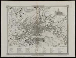
Glasgow
2748.
Glasgow
2749.
Gleason's new standard map of the world : on the projection of J. S. Christopher, Modern College, Blackheath, England ;...
2750.
Glens Falls, N.Y : 1875
2751.
Global map for global war and global peace
2752.
Globes
2753.
Gloucester, Essex County, Massachusetts : Oct. 1903
2754.
Gloucester Harbour, Village
2755.
Gloversville, N.Y : 1875
2756.
Goffstown, N.H. 1887
2757.
The gold and coal fields of Alaska : together with the principal steamer routes and trails
2758.
The good neighbor pictorial map of South America
2759.
The good things in life belong to all of us, let's protect them
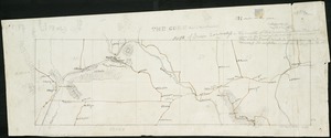
2760.
The Gore, part of Falls township, north of Green township
‹ Prev
Next ›
1
2
…
134
135
136
137
138
139
140
141
142
…
437
438