Toggle navigation
LMEC Home
Exhibitions
Georeferencing
Tools for Teachers
Collections
My Favorites
Sign Up / Log In
Search
Search the map portal
Map Collection
Map Collection
Map Sets
Search
Search
Search for
Search In
All Fields
Creator
Title
Subject
Place
Search All Digital Collections
Advanced Search
8671 Results
My Search
Start Over
More Like
commonwealth:0z7095075
Remove constraint More Like: commonwealth:0z7095075
Filter your Search
Place
North and Central America
5,908
United States
4,825
Massachusetts
2,068
Europe
1,392
Suffolk (county)
1,042
Boston
1,014
Canada
450
Asia
436
more
Place
»
Topic
Boston (Mass.)--Maps
582
United States--Maps
279
Real property--Massachusetts--Boston--Maps
175
Massachusetts--Maps
161
Landowners--Massachusetts--Boston--Maps
133
North America--Maps--Early works to 1800
102
New England--Maps
101
Manuscript maps
84
more
Topic
»
Date
Date range begin
–
Date range end
Current results range from
1482
to
2023
View distribution
Creator
United States. Hydrographic Office
595
O.H. Bailey & Co
148
Des Barres, Joseph F. W. (Joseph Frederick Wallet), 1722-1824
123
United States. Post Office Dept
120
Ptolemy, 2nd cent
100
Walling, Henry Francis, 1825-1888
94
Geological Survey (U.S.)
86
Jefferys, Thomas, -1771
85
more
Creator
»
Format
Maps/Atlases
8,611
Manuscripts
241
Prints
56
Books
36
Objects/Artifacts
10
Drawings/Illustrations
8
Posters
5
Georeferenced
Yes
869
No
7,802
Collection
Norman B. Leventhal Map & Education Center Collection
8,649
Boston and New England Maps
2,221
Urban Maps
1,991
Maritime Charts and Atlases
1,083
American Revolutionary War-Era Maps
638
Boston Redevelopment Authority Collection
87
Library of Congress Collection
22
Available to use
No known restrictions
8,504
Creative Commons license
72
Search Constraints
Sort by relevance
relevance
title
date (asc)
date (desc)
Number of results to display per page
20 per page
10
per page
20
per page
50
per page
100
per page
View results as:
grid view
map view
Search Results
4101.
Map of the County of Middlesex, New Jersey
4102.
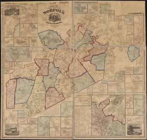
Map of the county of Norfolk, Massachusetts : based upon the trigonometrical survey of the state
4103.
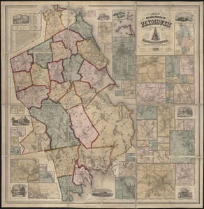
Map of the county of Plymouth, Massachusetts : from actual surveys under the direction of Henry F. Walling
4104.
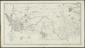
Map of the Department of Dakota including Minnesota, Dakota and Montana
4105.
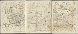
Map of the Department of Dakota including Minnesota, North Dakota, Montana, Yellowstone National Park, and that portion of...
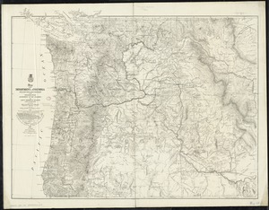
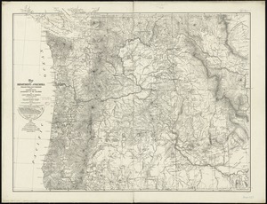
4106.
Map of the Department of the Columbia
4107.
Map of the Department of the Columbia
4108.
Map of the Diocese of Massachusetts showing the location of the Episcopal parishes and Missionary Stations
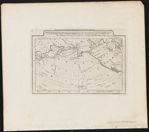
4109.
A map of the discoveries made by Capts. Cook & Clerke in the years 1778 & 1779 between the eastern coast of Asia and the...
4110.
A map of the discoveries made by the Russians on the North West coast of America
4111.
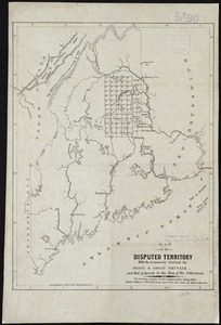
Map of the disputed territory [Maine] : reduced from the original of Messrs. Featherstonehaugh & Mudge, British commissioners
4112.
Map of the disputed territory with the boundaries claimed by Maine & Great Britain and that proposed by the King of the...
4113.
Map of the disputed territory,with a full description
4114.
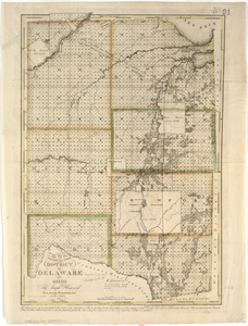
Map of the district of Delaware in Ohio
4115.
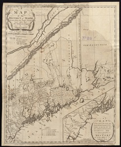
A map of the district of Maine, drawn from the latest surveys and other best authorities
4116.
Map of the district of Maine from the latest and best authorities
4117.
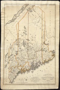
Map of the district of Maine, Massachusetts : compiled from actual surveys made by order of the General Court and under the...
4118.
Map of the Dominion of Canada : indicating natural resources, transportation and trade routes
4119.
Map of the Dominion of Canada : indicating natural resources, transportation and trade routes
4120.
Map of the Dominion of Canada
‹ Prev
Next ›
1
2
…
202
203
204
205
206
207
208
209
210
…
433
434


![Map of the disputed territory [Maine]](https://bpldcassets.blob.core.windows.net/derivatives/images/commonwealth:7h14b025h/image_thumbnail_300.jpg)