Toggle navigation
LMEC Home
Exhibitions
Georeferencing
Tools for Teachers
Collections
My Favorites
Sign Up / Log In
Search
Search the map portal
Map Collection
Map Collection
Map Sets
Search
Search
Search for
Search In
All Fields
Creator
Title
Subject
Place
Search All Digital Collections
Advanced Search
8722 Results
My Search
Start Over
More Like
commonwealth:0r96fp094
Remove constraint More Like: commonwealth:0r96fp094
Filter your Search
Place
North and Central America
5,962
United States
4,864
Massachusetts
2,139
Europe
1,392
Suffolk (county)
1,042
Boston
1,015
Canada
449
Asia
436
more
Place
»
Topic
Boston (Mass.)--Maps
586
United States--Maps
279
Massachusetts--Maps
233
Real property--Massachusetts--Boston--Maps
175
Landowners--Massachusetts--Boston--Maps
133
New England--Maps
102
North America--Maps--Early works to 1800
102
Europe--Maps
79
more
Topic
»
Date
Date range begin
–
Date range end
Current results range from
1482
to
2023
View distribution
Creator
United States. Hydrographic Office
595
O.H. Bailey & Co
148
Des Barres, Joseph F. W. (Joseph Frederick Wallet), 1722-1824
123
United States. Post Office Dept
120
Ptolemy, 2nd cent
100
Walling, Henry Francis, 1825-1888
95
Geological Survey (U.S.)
92
Jefferys, Thomas, -1771
85
more
Creator
»
Format
Maps/Atlases
8,661
Manuscripts
217
Prints
56
Books
36
Objects/Artifacts
10
Drawings/Illustrations
8
Posters
5
Ephemera
1
Georeferenced
Yes
879
No
7,843
Collection
Norman B. Leventhal Map & Education Center Collection
8,686
Boston and New England Maps
2,266
Urban Maps
1,992
Maritime Charts and Atlases
1,083
American Revolutionary War-Era Maps
637
Boston Redevelopment Authority Collection
90
Applied Geographics, Inc. Records
19
David Judkins Weaver Papers
17
more
Collection
»
Available to use
No known restrictions
8,544
Creative Commons license
51
Search Constraints
Sort by relevance
relevance
title
date (asc)
date (desc)
Number of results to display per page
20 per page
10
per page
20
per page
50
per page
100
per page
View results as:
grid view
map view
Search Results
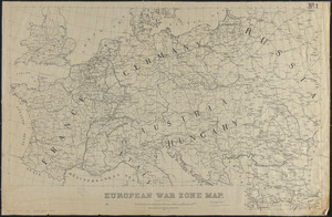
2421.
European war zone map
2422.
Evêché de Dijon
2423.
The Evening Post map of the West Indies
2424.
L'Evesche d'Aire
2425.
L'Evesché de Blois, dìvìsé en archìdìaconéz et doyennéz
2426.
L'Evesché de Blois, divisé en Archidiaconéz et Doyennéz
2427.
L'Evesché de Chartres dìvìsee en archìdìaconéz et doyennéz
2428.
Evesché de La Rochelle
2429.
Evesché de Laon, ou sont les Duché, et Pairrie de Laon, Balliages de Laon, et Ribemont, Eslections de Laon, et de Guise etc
2430.
Evesché de Luçon : dedié a Monseigneur ... Henry de Barrillon Evesque et Baron de Luçon etc
2431.
Evesché du Puy Le Velay l'un des vingt deux dioceses du Languedoc
2432.
Evropa
2433.
An exact chart of the river St. Laurence, from Fort Frontenac to the island of Anticosti shewing the soundings, rocks, shoals...
2434.
An exact chart of the river St. Laurence, from Fort Frontenac to the island of Anticosti shewing the soundings, rocks, shoals...
2435.
An exact draught of Bostone harbour with a survey of most of the islands about it
2436.
An exact draught of the gulf of Darien & the coast to Porto Bello with Panama in the south sea & the Scotch settlement in...
2437.
Exact plan of General Gage's lines on Boston Neck in America
2438.
An exact plan of the sea coast of the continent from Paucatuck River eastwards to Point Judith and from thence northwards to...
2439.
Exacta & accurata delineatio cùm orarum maritimarum tùm etjam locorum terrestrium qvæ in regionibus China, Cauchinchina,...
2440.
Exactissima Helvetiae, Rhaetiae, Valesiae caeterorumque Confoederatorum ut et finitimorum populorum regionum tabula :...
‹ Prev
Next ›
1
2
…
118
119
120
121
122
123
124
125
126
…
436
437