Toggle navigation
LMEC Home
Exhibitions
Georeferencing
Tools for Teachers
Collections
My Favorites
Sign Up / Log In
Search
Search the map portal
Map Collection
Map Collection
Map Sets
Search
Search
Search for
Search In
All Fields
Creator
Title
Subject
Place
Search All Digital Collections
Advanced Search
8728 Results
My Search
Start Over
More Like
commonwealth:0r96fk842
Remove constraint More Like: commonwealth:0r96fk842
Filter your Search
Place
North and Central America
5,956
United States
4,870
Massachusetts
2,081
Europe
1,396
Suffolk (county)
1,047
Boston
1,019
Canada
450
Asia
438
more
Place
»
Topic
Boston (Mass.)--Maps
587
United States--Maps
282
Real property--Massachusetts--Boston--Maps
175
Massachusetts--Maps
163
Landowners--Massachusetts--Boston--Maps
133
North America--Maps--Early works to 1800
103
New England--Maps
102
Manuscript maps
84
more
Topic
»
Date
Date range begin
–
Date range end
Current results range from
1482
to
2023
View distribution
Creator
United States. Hydrographic Office
595
O.H. Bailey & Co
148
Des Barres, Joseph F. W. (Joseph Frederick Wallet), 1722-1824
123
United States. Post Office Dept
120
Ptolemy, 2nd cent
100
Walling, Henry Francis, 1825-1888
94
Geological Survey (U.S.)
87
Jefferys, Thomas, -1771
85
more
Creator
»
Format
Maps/Atlases
8,668
Manuscripts
241
Prints
56
Books
36
Objects/Artifacts
10
Drawings/Illustrations
8
Posters
5
Georeferenced
Yes
869
No
7,859
Collection
Norman B. Leventhal Map & Education Center Collection
8,701
Boston and New England Maps
2,234
Urban Maps
2,023
Maritime Charts and Atlases
1,083
American Revolutionary War-Era Maps
640
Boston Redevelopment Authority Collection
87
Library of Congress Collection
22
Massachusetts Real Estate Atlases
5
more
Collection
»
Available to use
No known restrictions
8,556
Creative Commons license
72
Search Constraints
Sort by relevance
relevance
title
date (asc)
date (desc)
Number of results to display per page
20 per page
10
per page
20
per page
50
per page
100
per page
View results as:
grid view
map view
Search Results
21.
Door County, Wis.
22.
Douglas County, Wis.
23.
Dunn County, Wis.
24.
Eau Claire County, Wis.
25.
Fond du Lac County, Wis.
26.
Grant County, Wis.
27.
Green County, Wis.
28.
Iowa County, Wis.
29.
Jackson County, Wis.
30.
Jefferson County, Wis.
31.
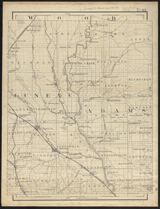
Juneau & Adams Counties, Wis.
32.
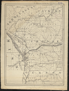
Lacrosse County, Wis.
33.
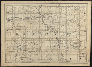
Lafayette County, Wis.
34.
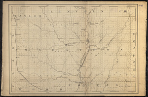
Lincoln County, Wis.
35.
A map of Massachusetts
36.
Map of the eastern and middle states
37.
Map of the town of Morris : Morris County New Jersey
38.
A map of the world
39.
Marathon, Wis.
40.
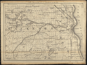
Milwaukee County and Waukesha County, Wis.
‹ Prev
Next ›
1
2
3
4
5
6
…
436
437