Toggle navigation
LMEC Home
Exhibitions
Georeferencing
Tools for Teachers
Collections
My Favorites
Sign Up / Log In
Search
Search the map portal
Map Collection
Map Collection
Map Sets
Search
Search
Search for
Search In
All Fields
Creator
Title
Subject
Place
Search All Digital Collections
Advanced Search
51 Results
My Search
Start Over
More Like
commonwealth:7h14cw20p
Remove constraint More Like: commonwealth:7h14cw20p
Place
South End
Remove constraint Place: South End
Filter your Search
Place
Boston
51
Massachusetts
51
North and Central America
51
South End
[remove]
51
Suffolk (county)
51
United States
51
Chinatown
5
Roxbury
5
more
Place
»
Topic
City planning--Massachusetts--Boston--Maps
48
South End (Boston, Mass.)--Maps
44
Urban renewal--Massachusetts--Boston--Maps
17
Land use--Massachusetts--Boston--Maps
11
Buildings--Massachusetts--Boston--Maps
10
Real property--Massachusetts--Boston--Maps
7
Roads--Right of way--Massachusetts--Boston--Maps
6
Chinatown (Boston, Mass.)--Maps
5
more
Topic
»
Date
Date range begin
–
Date range end
Current results range from
1852
to
1999
1852 : 2000
1852
2000
View distribution
Creator
Boston Redevelopment Authority
49
Stull and Lee, Inc.
3
Erickson, Roger C.
1
Fairchild Aerial Surveys, inc.
1
Johnson, Ann
1
McCarthy, D.
1
New England Survey Service, inc.
1
Swaile, Sandra
1
Format
Maps/Atlases
51
Drawings/Illustrations
1
Georeferenced
No
51
Collection
Boston and New England Maps
51
Urban Maps
51
Boston Redevelopment Authority Collection
50
Norman B. Leventhal Map & Education Center Collection
13
Available to use
No known restrictions
51
Search Constraints
Sort by relevance
relevance
title
date (asc)
date (desc)
Number of results to display per page
20 per page
10
per page
20
per page
50
per page
100
per page
View results as:
grid view
map view
Search Results
1.
City of Boston topographic and planimetric survey
2.
Herald Street improvements
3.
Illustrative site plan : a proposal for community review South End/Lower Roxbury development policy
4.
Illustrative site plan : South End urban renewal area, Massachusetts r-56
5.
Illustrative site plan : a proposal for community review South End/Lower Roxbury development policy
6.
Land use New York streets - South Cove 1953
7.
Relationship of TNEMC development plan area to New York streets land assembly and redevelopment project
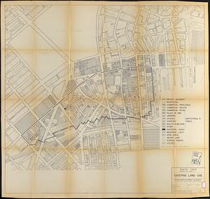
8.
South Cove project no. Mass r- : existing land use
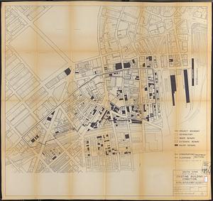
9.
South Cove project no. Mass. r- : existing building condition
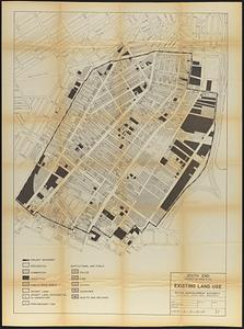
10.
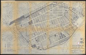
South End project no. Mass. r-56 : existing land use
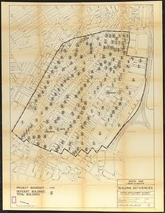
11.
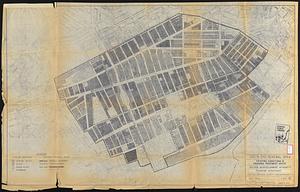
South End project no. Mass. r-56 : building deficiencies
12.
South End renewal area : locality map
13.
South End renewal area : existing conditions & proposed treatment areas
14.
South End renewal area : existing land use
15.
South End renewal area : blighted areas
16.
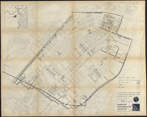
South End urban renewal area R-56 : property map
17.
South End urban renewal area R-56 : property map
18.
South End urban renewal area R-56 : property map
19.
South End urban renewal area R-56 : proposed rights-of-way
20.
South End urban renewal area R-56 : re-use parcels
‹ Prev
Next ›
1
2
3