Toggle navigation
LMEC Home
Exhibitions
Georeferencing
Tools for Teachers
Collections
My Favorites
Sign Up / Log In
Search
Search the map portal
Map Collection
Map Collection
Map Sets
Search
Search
Search for
Search In
All Fields
Creator
Title
Subject
Place
Search All Digital Collections
Advanced Search
50 Results
My Search
Start Over
More Like
commonwealth-oai:fb4988519
Remove constraint More Like: commonwealth-oai:fb4988519
Place
Massachusetts
Remove constraint Place: Massachusetts
Filter your Search
Place
Massachusetts
[remove]
50
North and Central America
50
United States
50
Boston
24
Suffolk (county)
24
Middlesex (county)
13
Boston Harbor
11
Charlestown
6
more
Place
»
Topic
United States--History--Revolution, 1775-1783--Maps
24
Boston (Mass.)--Maps
12
Boston Harbor (Mass.)--Maps
11
Massachusetts--Maps
9
Bunker Hill, Battle of, Boston, Mass., 1775--Maps
5
Boston (Mass.)--History--Siege, 1775-1776--Maps
4
Canals--Massachusetts--Maps
4
Middlesex Canal (Mass.)--Maps
4
more
Topic
»
Date
Date range begin
–
Date range end
Current results range from
1755
to
1899
1755 : 1900
1755
1900
View distribution
Creator
Baldwin, Loammi, 1745-1807
2
Baldwin, Loammi, 1780-1838
2
Carleton, Osgood, 1742-1816
2
De Costa, J.
2
Hall, Charles, 1720?-1783
2
Montrésor, John, 1736-1799
2
Thompson, Samuel, surveyor
2
André, John, 1751-1780
1
more
Creator
»
Format
Maps/Atlases
48
Drawings/Illustrations
2
Georeferenced
Yes
1
No
49
Collection
American Revolutionary War-Era Maps
46
William L. Clements Library Collection
41
Boston and New England Maps
5
Norman B. Leventhal Map & Education Center Collection
5
Maps from AAS
4
Urban Maps
3
Available to use
No known restrictions
5
Search Constraints
Sort by relevance
relevance
title
date (asc)
date (desc)
Number of results to display per page
20 per page
10
per page
20
per page
50
per page
100
per page
View results as:
grid view
map view
Search Results
1.
Bedford
2.
Boston
3.
Boston Harbor
4.
Boston Harbor, 1778
5.
Cambridge to Prospect Hill
6.
A draught of the towns of Boston & Charles Town & the circumjacent country, shewing the works thrown up by the kings troops, &...
7.
Exact plan of General Gage's lines on Boston Neck in America
8.
A map of the environs of Boston
9.
A new and correct plan of the town of Boston
10.
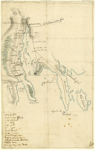
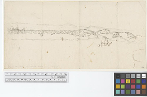
[Perspecti]ve view of the environs of [Bosto]n from Beacon Hill shewing the rebels [works?] & encampmentss, July 22d, 1775
11.
A plan of Boston in New England with its environs, including Milton, Dorchester, Roxbury, Brooklin, Cambridge, Medford,...
12.
A plan of the town and harbour of Boston and the country adjacent with the road from Boston to Concord shewing the place of the...
13.
Plan of the town of Boston with the attack on Bunkers-Hill in the peninsula of Charlestown the 17th of June 1775
14.
A survey of the peninsula of Charles Town shewing the three posts now garrison'd by his majesty's troops for the winter : 10th...
15.
Thirty-miles round Boston
16.
Boston its environs and harbour, : with the rebels works raised against that town in 1775, from the observations of Lieut. Page...
17.
Boston with its environs
18.
Centennial map of Concord, 1775-1875
19.
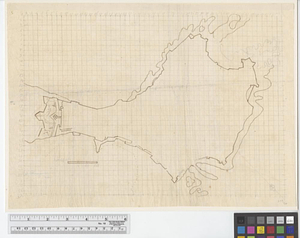
[Chart of Boston Harbor and the surrounding areas]
20.
Gen. Washington's Revolutionary campaign war map : after a survey ordered by him showing the position of his army in defence of...
+
-
Redo search here
Search when I move the map
Leaflet
| ©
OpenStreetMap
contributors, ©
CartoDB
‹ Prev
Next ›
1
2
3


![[Perspecti]ve view of the environs of [Bosto]n from Beacon Hill shewing the rebels [works?] & encampmentss, July 22d, 1775](https://bpldcassets.blob.core.windows.net/derivatives/metadata/commonwealth-oai:6d573t29z/image_thumbnail_300.jpg)


![[Chart of Boston Harbor and the surrounding areas]](https://bpldcassets.blob.core.windows.net/derivatives/images/commonwealth:6108vs71d/image_thumbnail_300.jpg)