Toggle navigation
LMEC Home
Exhibitions
Georeferencing
Tools for Teachers
Collections
My Favorites
Sign Up / Log In
Search
Search the map portal
Map Collection
Map Collection
Map Sets
Search
Search
Search for
Search In
All Fields
Creator
Title
Subject
Place
Search All Digital Collections
Advanced Search
3 Results
My Search
Start Over
More Like
commonwealth:6395x8434
Remove constraint More Like: commonwealth:6395x8434
Available to use
Creative Commons license
Remove constraint Available to use: Creative Commons license
Filter your Search
Place
North and Central America
3
United States
3
Amherst
1
Erie (county)
1
Lower Bay
1
New York
1
Upper Bay
1
Topic
Coastlines
1
Harbors
1
Navigation
1
Streets
1
Date
Date range begin
–
Date range end
Current results range from
1927
to
2005
1927 : 2006
1927
2006
View distribution
Creator
A. Hoen & Co.
1
American Geographical Society of New York
1
Format
Maps/Atlases
3
Georeferenced
No
3
Collection
Robert E. Diefenbach Map Collection at Phillips Academy
3
Available to use
Creative Commons license
[remove]
3
Search Constraints
Sort by relevance
relevance
title
date (asc)
date (desc)
Number of results to display per page
20 per page
10
per page
20
per page
50
per page
100
per page
View results as:
grid view
map view
Search Results
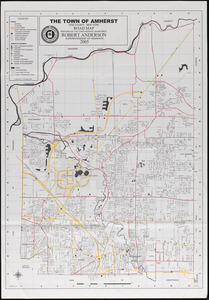
1.
Amherst map & guide
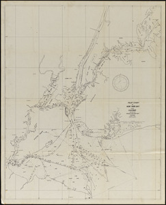
2.
Pilot chart of New York Bay and Harbor for use with Krause's New York pilot courses
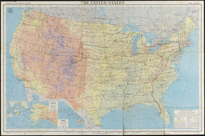
3.
The United States