Toggle navigation
LMEC Home
Exhibitions
Georeferencing
Tools for Teachers
Collections
My Favorites
Sign Up / Log In
Search
Search the map portal
Map Collection
Map Collection
Map Sets
Search
Search
Search for
Search In
All Fields
Creator
Title
Subject
Place
Search All Digital Collections
Advanced Search
1 Results
My Search
Start Over
More Like
commonwealth-oai:js95bg08k
Remove constraint More Like: commonwealth-oai:js95bg08k
Format
Prints
Remove constraint Format: Prints
Filter your Search
Place
New York
1
North and Central America
1
Oswego
1
Oswego (county)
1
United States
1
Topic
Oswego (N.Y.)--Maps
1
United States--History--French and Indian War, 1754-1763--Maps
1
Date
1760
1
Format
Prints
[remove]
1
Georeferenced
No
1
Collection
American Revolutionary War-Era Maps
1
William L. Clements Library Collection
1
Search Constraints
Sort by relevance
relevance
title
date (asc)
date (desc)
Number of results to display per page
20 per page
10
per page
20
per page
50
per page
100
per page
View results as:
grid view
map view
Search Results
1.
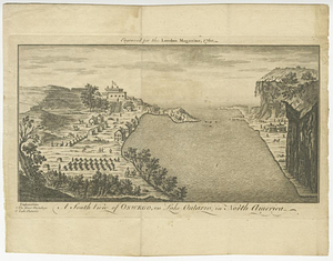
A south view of Oswego, on Lake Ontario, in North America