Toggle navigation
LMEC Home
Exhibitions
Georeferencing
Tools for Teachers
Collections
My Favorites
Sign Up / Log In
Search
Search the map portal
Map Collection
Map Collection
Map Sets
Search
Search
Search for
Search In
All Fields
Creator
Title
Subject
Place
Search All Digital Collections
Advanced Search
13684 Results
Filter your Search
Place
North and Central America
10,345
United States
8,476
Massachusetts
2,789
Suffolk (county)
1,677
Boston
1,633
Europe
1,418
Canada
950
New York
649
more
Place
»
Topic
Boston (Mass.)--Maps
747
City planning--Massachusetts--Boston--Maps
418
United States--History--Revolution, 1775-1783--Maps
329
United States--Maps
322
Real property--Massachusetts--Boston--Maps
254
Urban renewal--Massachusetts--Boston--Maps
254
Massachusetts--Maps
231
Insurance surveys
197
more
Topic
»
Date
Date range begin
–
Date range end
Current results range from
1482
to
2023
View distribution
Creator
United States. Hydrographic Office
597
Boston Redevelopment Authority
404
Des Barres, Joseph F. W. (Joseph Frederick Wallet), 1722-1824
247
Royal United Services Institute for Defence and Security Studies
160
Jefferys, Thomas, -1771
154
George, III, King of Great Britain, 1738-1820
152
George, IV, King of Great Britain, 1762-1830
151
O.H. Bailey & Co
148
more
Creator
»
Format
Maps/Atlases
13,503
Manuscripts
985
Prints
102
Books
49
Drawings/Illustrations
44
Photographs
15
Objects/Artifacts
13
Documents
7
more
Format
»
Georeferenced
Yes
979
No
12,705
Collection
Norman B. Leventhal Map & Education Center Collection
9,099
American Revolutionary War-Era Maps
3,305
Boston and New England Maps
2,915
Urban Maps
2,474
Maritime Charts and Atlases
1,169
William L. Clements Library Collection
910
Library of Congress Collection
618
Boston Redevelopment Authority Collection
475
more
Collection
»
Available to use
No known restrictions
10,250
Creative Commons license
1,678
Search Constraints
Sort by relevance
relevance
title
date (asc)
date (desc)
Number of results to display per page
20 per page
10
per page
20
per page
50
per page
100
per page
View results as:
grid view
map view
Search Results
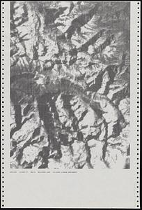
3061.
Dot matrix printouts of Landsat satellite images
3062.
Dotted line map of Washington, D.C., 1791, before Aug. 19th
3063.
Douglas County, Wis.
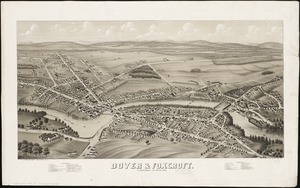
3064.
Dover & Foxcroft : Piscataquis Co. Maine, 1878
3065.
Dover, Delaware : 1885
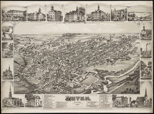
3066.
Dover Stamping Company, Fall River, Mass. [insurance map]
3067.
Downtown and neighborhood cultural facilities
3068.
Downtown Boston
3069.
Downtown district of Manhattan
3070.
Downtown existing buildings conditions
3071.
Downtown flood progression, 36 inches sea level rise
3072.
Downtown project no. Mass. r-46 : existing and proposed community facilities
3073.
Downtown project no. Mass. r-46 : proposed circulation and boundary adjustments
3074.
Downtown project no. Mass. r-46 : existing land use
3075.
Downtown Waterfront Faneuil Hall renewal area : locality map 1
3076.
Downtown waterfront-Faneuil Hall project urban renewal area Massachusetts R-77 : illustrative site plan
3077.
Downtown waterfront-Faneuil Hall project urban renewal area Massachusetts R-77 : illustrative site plan
3078.
Downtown waterfront-Faneuil Hall project urban renewal area Massachusetts R-77 : existing and proposed zoning
3079.
Downtown waterfront-Faneuil Hall project urban renewal area Massachusetts R-77 : existing and proposed zoning
3080.
Downtown Waterfront-Faneuil Hall renewal area : existing land use
‹ Prev
Next ›
1
2
…
150
151
152
153
154
155
156
157
158
…
684
685


![Dover Stamping Company, Fall River, Mass. [insurance map]](https://bpldcassets.blob.core.windows.net/derivatives/images/commonwealth:4j03df57j/image_thumbnail_300.jpg)


