Toggle navigation
LMEC Home
Exhibitions
Georeferencing
Tools for Teachers
Collections
My Favorites
Sign Up / Log In
Search
Search the map portal
Map Collection
Map Collection
Map Sets
Search
Search
Search for
Search In
All Fields
Creator
Title
Subject
Place
Search All Digital Collections
Advanced Search
13507 Results
Filter your Search
Place
North and Central America
10,222
United States
8,357
Massachusetts
2,773
Suffolk (county)
1,670
Boston
1,626
Europe
1,386
Canada
949
New York
640
more
Place
»
Topic
Boston (Mass.)--Maps
743
City planning--Massachusetts--Boston--Maps
418
United States--History--Revolution, 1775-1783--Maps
329
United States--Maps
320
Urban renewal--Massachusetts--Boston--Maps
254
Real property--Massachusetts--Boston--Maps
253
Massachusetts--Maps
230
Insurance surveys
197
more
Topic
»
Date
Date range begin
–
Date range end
Current results range from
1482
to
2023
View distribution
Creator
United States. Hydrographic Office
596
Boston Redevelopment Authority
404
Des Barres, Joseph F. W. (Joseph Frederick Wallet), 1722-1824
247
Royal United Services Institute for Defence and Security Studies
160
Jefferys, Thomas, -1771
154
George, III, King of Great Britain, 1738-1820
152
George, IV, King of Great Britain, 1762-1830
151
O.H. Bailey & Co
148
more
Creator
»
Format
Maps/Atlases
13,326
Manuscripts
985
Prints
102
Books
49
Drawings/Illustrations
44
Photographs
15
Objects/Artifacts
13
Documents
7
more
Format
»
Georeferenced
Yes
979
No
12,528
Collection
Norman B. Leventhal Map & Education Center Collection
9,013
American Revolutionary War-Era Maps
3,305
Boston and New England Maps
2,895
Urban Maps
2,421
Maritime Charts and Atlases
1,167
William L. Clements Library Collection
910
Library of Congress Collection
618
Boston Redevelopment Authority Collection
475
more
Collection
»
Available to use
No known restrictions
10,074
Creative Commons license
1,677
Search Constraints
Sort by relevance
relevance
title
date (asc)
date (desc)
Number of results to display per page
20 per page
10
per page
20
per page
50
per page
100
per page
View results as:
grid view
map view
Search Results
13381.
White Plains
13382.
Whitinsville, Mass.
13383.
Whitinsville, Massachusetts : 1891
13384.
Whitman, Massachusetts : 1889
13385.
Whitman Mills (Cotton Mill), New Bedford, Mass. [insurance map]
13386.
Whitman National Forest, Blue Mountains Division, Oregon
13387.
Whitman National Forest, Minam Division, Oregon
13388.
The whole story in a nutshell!
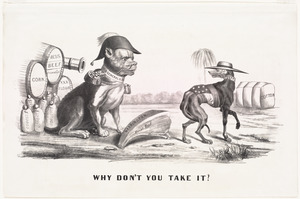
13389.
Why don't you take it?
13390.
Wickford, Rhode Island : 1888
13391.
Wigorniensis comitatus cum Warwicensi, nec non Conventriae Libertas
13392.
Wilbraham
13393.
Wilcox Manufacturing Company, Bldg., Kalco Textile Company, Inc. et al., Ten., New Bedford, Mass. [insurance map]
13394.
The Wilderness
13395.
Willard's new map of the Hudson River
13396.
[Willard's new map of the Hudson River for 1844]
13397.
William G. Schoonover & Linton A. Thrasher (Bldg.), Joseph P. Duchaine d/b/a My Bread Baking Co. (Ten.), New Bedford, Mass....
13398.
William Gropper's America, its folklore
13399.
Williams' telegraph and rail road map of the New England states, eastern portion of New York state and Canada
13400.
Williams' telegraph and rail road map of the New England states, eastern protion of New York state and Canada : compiled from...
‹ Prev
Next ›
1
2
…
666
667
668
669
670
671
672
673
674
675
676


![Whitman Mills (Cotton Mill), New Bedford, Mass. [insurance map]](https://bpldcassets.blob.core.windows.net/derivatives/images/commonwealth:ww72c001v/image_thumbnail_300.jpg)


![Wilcox Manufacturing Company, Bldg., Kalco Textile Company, Inc. et al., Ten., New Bedford, Mass. [insurance map]](https://bpldcassets.blob.core.windows.net/derivatives/images/commonwealth:ww72c004p/image_thumbnail_300.jpg)


![[Willard's new map of the Hudson River for 1844]](https://bpldcassets.blob.core.windows.net/derivatives/images/commonwealth:b8516310f/image_thumbnail_300.jpg)
![William G. Schoonover & Linton A. Thrasher (Bldg.), Joseph P. Duchaine d/b/a My Bread Baking Co. (Ten.), New Bedford, Mass. [insurance map]](https://bpldcassets.blob.core.windows.net/derivatives/images/commonwealth:ww72bz99v/image_thumbnail_300.jpg)


