Toggle navigation
LMEC Home
Exhibitions
Georeferencing
Tools for Teachers
Collections
My Favorites
Sign Up / Log In
Search
Search the map portal
Map Collection
Map Collection
Map Sets
Search
Search
Search for
Search In
All Fields
Creator
Title
Subject
Place
Search All Digital Collections
Advanced Search
13385 Results
Filter your Search
Place
North and Central America
10,111
United States
8,249
Massachusetts
2,691
Suffolk (county)
1,664
Boston
1,621
Europe
1,386
Canada
949
New York
640
more
Place
»
Topic
Boston (Mass.)--Maps
741
City planning--Massachusetts--Boston--Maps
418
United States--History--Revolution, 1775-1783--Maps
329
United States--Maps
315
Urban renewal--Massachusetts--Boston--Maps
254
Real property--Massachusetts--Boston--Maps
252
Massachusetts--Maps
219
Insurance surveys
197
more
Topic
»
Date
Date range begin
–
Date range end
Current results range from
1482
to
2023
View distribution
Creator
United States. Hydrographic Office
595
Boston Redevelopment Authority
403
Des Barres, Joseph F. W. (Joseph Frederick Wallet), 1722-1824
247
Royal United Services Institute for Defence and Security Studies
160
Jefferys, Thomas, -1771
154
George, III, King of Great Britain, 1738-1820
152
George, IV, King of Great Britain, 1762-1830
151
O.H. Bailey & Co
148
more
Creator
»
Format
Maps/Atlases
13,205
Manuscripts
985
Prints
102
Books
49
Drawings/Illustrations
44
Photographs
15
Objects/Artifacts
13
Documents
7
more
Format
»
Georeferenced
Yes
979
No
12,406
Collection
Norman B. Leventhal Map & Education Center Collection
8,891
American Revolutionary War-Era Maps
3,305
Boston and New England Maps
2,804
Urban Maps
2,397
Maritime Charts and Atlases
1,150
William L. Clements Library Collection
910
Library of Congress Collection
618
Boston Redevelopment Authority Collection
475
more
Collection
»
Available to use
No known restrictions
9,952
Creative Commons license
1,677
Search Constraints
Sort by relevance
relevance
title
date (asc)
date (desc)
Number of results to display per page
20 per page
10
per page
20
per page
50
per page
100
per page
View results as:
grid view
map view
Search Results
5501.
Map of the city of Boston Massachusetts
5502.
Map of the city of Boston, Massts., 1852
5503.
Map of the City of Brooklyn as consolidated by an act of the legislature of the State of New York : including Brooklyn,...
5504.
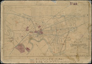
Map of the city of Cambridge
5505.
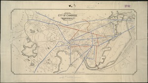
Map of the city of Cambridge
5506.
Map of the city of Cambridge : reduced from J. Hayward's, 1838 : with additions and corrections
5507.
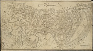
Map of the city of Cambridge
5508.
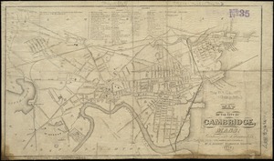
Map of the city of Cambridge
5509.
Map of the city of Cambridge, Mass : reduced from J. Hayward's 1838 : with additions and corrections
5510.
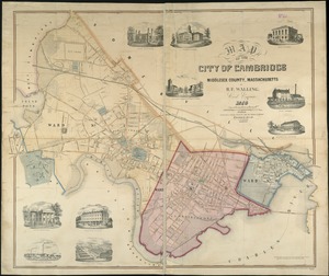
Map of the city of Cambridge, Middlesex County, Massachusetts
5511.
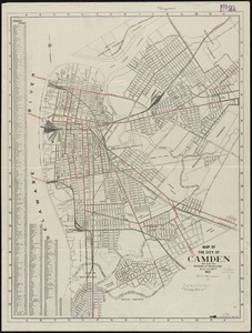
Map of the City of Camden and also the Borough of Wood Lynne
5512.
Map of the city of Charleston, S.C. and vicinity : with table of reference to principle buildings, points of historical interest
5513.
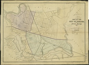
Map of the city of Chelsea : from actual surveys 1867
5514.
Map of the city of Chelsea from actual surveys : 1884
5515.
Map of the city of Concord New Hampshire
5516.
Map of the city of Davenport and its suburbs, Scott County, Iowa
5517.
Map of the city of Fall River, Mass.
5518.
Map of the city of Gloucester, Mass
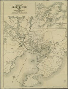
5519.
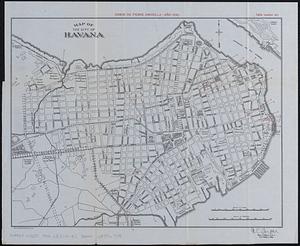
Map of the city of Havana : [casos de fiebre amarilla, muertes de niños menores, y muertes de tuberculosis]
5520.
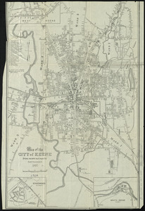
Map of the city of Keene, from recent surveys
‹ Prev
Next ›
1
2
…
272
273
274
275
276
277
278
279
280
…
669
670