Toggle navigation
LMEC Home
Exhibitions
Georeferencing
Tools for Teachers
Collections
My Favorites
Sign Up / Log In
Search
Search the map portal
Map Collection
Map Collection
Map Sets
Search
Search
Search for
Search In
All Fields
Creator
Title
Subject
Place
Search All Digital Collections
Advanced Search
13448 Results
Filter your Search
Place
North and Central America
10,170
United States
8,307
Massachusetts
2,741
Suffolk (county)
1,667
Boston
1,623
Europe
1,386
Canada
949
New York
640
more
Place
»
Topic
Boston (Mass.)--Maps
742
City planning--Massachusetts--Boston--Maps
418
United States--History--Revolution, 1775-1783--Maps
329
United States--Maps
315
Urban renewal--Massachusetts--Boston--Maps
254
Real property--Massachusetts--Boston--Maps
252
Massachusetts--Maps
228
Insurance surveys
197
more
Topic
»
Date
Date range begin
–
Date range end
Current results range from
1482
to
2023
View distribution
Creator
United States. Hydrographic Office
595
Boston Redevelopment Authority
403
Des Barres, Joseph F. W. (Joseph Frederick Wallet), 1722-1824
247
Royal United Services Institute for Defence and Security Studies
160
Jefferys, Thomas, -1771
154
George, III, King of Great Britain, 1738-1820
152
George, IV, King of Great Britain, 1762-1830
151
O.H. Bailey & Co
148
more
Creator
»
Format
Maps/Atlases
13,267
Manuscripts
985
Prints
102
Books
49
Drawings/Illustrations
44
Photographs
15
Objects/Artifacts
13
Documents
7
more
Format
»
Georeferenced
Yes
979
No
12,469
Collection
Norman B. Leventhal Map & Education Center Collection
8,954
American Revolutionary War-Era Maps
3,305
Boston and New England Maps
2,858
Urban Maps
2,402
Maritime Charts and Atlases
1,161
William L. Clements Library Collection
910
Library of Congress Collection
618
Boston Redevelopment Authority Collection
475
more
Collection
»
Available to use
No known restrictions
10,015
Creative Commons license
1,677
Search Constraints
Sort by relevance
relevance
title
date (asc)
date (desc)
Number of results to display per page
20 per page
10
per page
20
per page
50
per page
100
per page
View results as:
grid view
map view
Search Results
2961.
Downtown project no. Mass. r-46 : existing land use
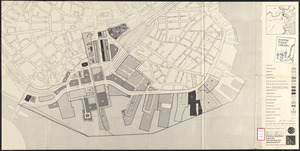
2962.
Downtown Waterfront Faneuil Hall renewal area : locality map 1
2963.
Downtown waterfront-Faneuil Hall project urban renewal area Massachusetts R-77 : illustrative site plan
2964.
Downtown waterfront-Faneuil Hall project urban renewal area Massachusetts R-77 : illustrative site plan
2965.
Downtown waterfront-Faneuil Hall project urban renewal area Massachusetts R-77 : existing and proposed zoning
2966.
Downtown waterfront-Faneuil Hall project urban renewal area Massachusetts R-77 : existing and proposed zoning
2967.
Downtown Waterfront-Faneuil Hall renewal area : existing land use
2968.
Downtown Waterfront-Faneuil Hall renewal area : building conditions
2969.
Downtown Waterfront-Faneuil Hall renewal area : locality map 2
2970.
Downtown waterfront-Faneuil Hall urban area Massachusetts R-77 : existing and proposed zoning
2971.
Downtown waterfront-Faneuil Hall urban area Massachusetts R-77 : proposed land use
2972.
Downtown waterfront-Faneuil Hall urban renewal area Massachusetts R-77 : proposed land use
2973.
Downtown waterfront-Faneuil Hall urban renewal area Massachusetts R-77 : proposed land use
2974.
Downtown waterfront-Faneuil Hall urban renewal area Massachusetts R-77 : proposed land use
2975.
Downtown waterfront-Faneuil Hall urban renewal area Massachusetts R-77 : street adjustments
2976.
Downtown waterfront-Faneuil Hall urban renewal area Massachusetts R-77 : property
2977.
Downtown waterfront-Faneuil Hall urban renewal area Massachusetts R-77 : property
2978.
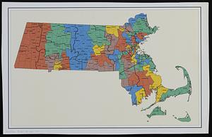
Draft of a map of 1993 Massachusetts Senate legislative districts
2979.
Draft of roads in New Jersey
2980.
A draft of the Golden & adjacent Islands, with part of ye Isthmus of Darien as it was taken by Capt. Ienefer where ye Scots...
‹ Prev
Next ›
1
2
…
145
146
147
148
149
150
151
152
153
…
672
673