Toggle navigation
LMEC Home
Exhibitions
Georeferencing
Tools for Teachers
Collections
My Favorites
Sign Up / Log In
Search
Search the map portal
Map Collection
Map Collection
Map Sets
Search
Search
Search for
Search In
All Fields
Creator
Title
Subject
Place
Search All Digital Collections
Advanced Search
13407 Results
Filter your Search
Place
North and Central America
10,133
United States
8,271
Massachusetts
2,711
Suffolk (county)
1,664
Boston
1,621
Europe
1,386
Canada
949
New York
640
more
Place
»
Topic
Boston (Mass.)--Maps
741
City planning--Massachusetts--Boston--Maps
418
United States--History--Revolution, 1775-1783--Maps
329
United States--Maps
315
Urban renewal--Massachusetts--Boston--Maps
254
Real property--Massachusetts--Boston--Maps
252
Massachusetts--Maps
221
Insurance surveys
197
more
Topic
»
Date
Date range begin
–
Date range end
Current results range from
1482
to
2023
View distribution
Creator
United States. Hydrographic Office
595
Boston Redevelopment Authority
403
Des Barres, Joseph F. W. (Joseph Frederick Wallet), 1722-1824
247
Royal United Services Institute for Defence and Security Studies
160
Jefferys, Thomas, -1771
154
George, III, King of Great Britain, 1738-1820
152
George, IV, King of Great Britain, 1762-1830
151
O.H. Bailey & Co
148
more
Creator
»
Format
Maps/Atlases
13,227
Manuscripts
985
Prints
102
Books
49
Drawings/Illustrations
44
Photographs
15
Objects/Artifacts
13
Documents
7
more
Format
»
Georeferenced
Yes
979
No
12,428
Collection
Norman B. Leventhal Map & Education Center Collection
8,913
American Revolutionary War-Era Maps
3,305
Boston and New England Maps
2,826
Urban Maps
2,402
Maritime Charts and Atlases
1,150
William L. Clements Library Collection
910
Library of Congress Collection
618
Boston Redevelopment Authority Collection
475
more
Collection
»
Available to use
No known restrictions
9,974
Creative Commons license
1,677
Search Constraints
Sort by relevance
relevance
title
date (asc)
date (desc)
Number of results to display per page
20 per page
10
per page
20
per page
50
per page
100
per page
View results as:
grid view
map view
Search Results
2401.
The coast from St. Johns, New Brunswick, to Goldsborough Bay, Maine
2402.
The coast of a part of New England, New York, New Jersey, Pensilvania, Maryland, Virginia, and part of North Carolina &c. with...
2403.
The coast of a part of North Carolina, South Carolina, Georgia and part of East Florida, with the bays, soundings, banks, roks,...
2404.
The coast of Florida from the Dry Tortugas to the old Cape
2405.
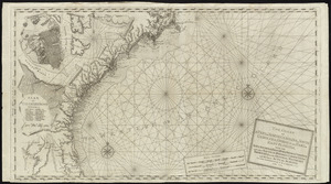
[Coast of Maine from Frenchman Bay to Mosquito Harbor]
2406.
Coast of Maine from Frenchman Bay to Mosquito Harbor
2407.
The coast of Maine from modern Portland to Desert Island
2408.
Coast of Maine from Moose Cove to Gouldsboro Bay
2409.
Coast of Maine from Moose Cove to Gouldsboro Bay
2410.
Coast of Maine from Mosquito Head to Spurwink River
2411.
Coast of Maine from Mosquito Head to Spurwink River
2412.
Coast of Maine from Rockland Harbor to Pemaquid Point
2413.
Coast of Maine from Rockland Harbor to Pemaquid Point
2414.
Coast of Maine from Salter Island to Portland Head
2415.
Coast of Maine from Salter Island to Portland Head
2416.
Coast of Maine showing Blue Hill Bay, Penobscot Bay, Belfast Bay, Islesboro Island, Deer Island, and other islands
2417.
Coast of Maine showing Blue Hill Bay, Penobscot Bay, Belfast Bay, Islesboro Island, Deer Island, and other islands
2418.
Coast of Maine showing entrances of Blue Hill Bay, Isle of Haut Bay, and Penobscot Bay, with Owls Head, Vinalhaven Island, Isle...
2419.
Coast of Maine showing entrances of Blue Hill Bay, Isle of Haut Bay, and Penobscot Bay, with Owls Head, Vinalhaven Island, Isle...
2420.
Coast of Massachusetts from Cape Ann to Manomet Point, including northern tip of Cape Cod
‹ Prev
Next ›
1
2
…
117
118
119
120
121
122
123
124
125
…
670
671


![[Coast of Maine from Frenchman Bay to Mosquito Harbor]](https://bpldcassets.blob.core.windows.net/derivatives/images/commonwealth:cj82m295n/image_thumbnail_300.jpg)


