Toggle navigation
LMEC Home
Exhibitions
Georeferencing
Tools for Teachers
Collections
My Favorites
Sign Up / Log In
Search
Search the map portal
Map Collection
Map Collection
Map Sets
Search
Search
Search for
Search In
All Fields
Creator
Title
Subject
Place
Search All Digital Collections
Advanced Search
13588 Results
Filter your Search
Place
North and Central America
10,254
United States
8,385
Massachusetts
2,784
Suffolk (county)
1,677
Boston
1,633
Europe
1,413
Canada
950
New York
646
more
Place
»
Topic
Boston (Mass.)--Maps
747
City planning--Massachusetts--Boston--Maps
418
United States--History--Revolution, 1775-1783--Maps
329
United States--Maps
321
Real property--Massachusetts--Boston--Maps
254
Urban renewal--Massachusetts--Boston--Maps
254
Massachusetts--Maps
231
Insurance surveys
197
more
Topic
»
Date
Date range begin
–
Date range end
Current results range from
1482
to
2023
View distribution
Creator
United States. Hydrographic Office
597
Boston Redevelopment Authority
404
Des Barres, Joseph F. W. (Joseph Frederick Wallet), 1722-1824
247
Royal United Services Institute for Defence and Security Studies
160
Jefferys, Thomas, -1771
154
George, III, King of Great Britain, 1738-1820
152
George, IV, King of Great Britain, 1762-1830
151
O.H. Bailey & Co
148
more
Creator
»
Format
Maps/Atlases
13,407
Manuscripts
985
Prints
102
Books
49
Drawings/Illustrations
44
Photographs
15
Objects/Artifacts
13
Documents
7
more
Format
»
Georeferenced
Yes
979
No
12,609
Collection
Norman B. Leventhal Map & Education Center Collection
9,088
American Revolutionary War-Era Maps
3,305
Boston and New England Maps
2,906
Urban Maps
2,465
Maritime Charts and Atlases
1,169
William L. Clements Library Collection
910
Library of Congress Collection
618
Boston Redevelopment Authority Collection
475
more
Collection
»
Available to use
No known restrictions
10,155
Creative Commons license
1,677
Search Constraints
Sort by relevance
relevance
title
date (asc)
date (desc)
Number of results to display per page
20 per page
10
per page
20
per page
50
per page
100
per page
View results as:
grid view
map view
Search Results
13201.
Wakefield, Massachusetts : diagram showing the first ten miles of the Boston & Maine Railroad
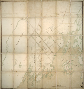
13202.
Wakefield [Massachusetts] ; Greenwood ; Melrose
13203.
Wakes Island ; Vatoa or Turtle Island and Vuata Vatoa ; Taloo Harbour, Island of Eimeo
13204.
Die Walachei
13205.
Waldo Patent, District of Maine between 1798 and 1802
13206.
Waldoboro, Lincoln County, Maine, 1896
13207.
Wales
13208.
Walling and Gray's map of the United States and territories
13209.
Wallis's plan of the cities of London & Westminster
13210.
Wallis's tour through the United Kingdom of England, Scotland and Ireland, a new geographical game, comprehending all the...
13211.
Wallowa National Forest, Oregon
13212.
Walpole, Massachusetts : 1882
13213.
Waltham, 1911
13214.
Walworth County, Wis.
13215.
Wamsutta Mills (Cotton Mill), New Bedford, Mass. [insurance map]
13216.
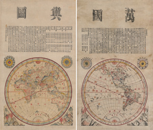
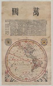
Wanguo yutu
13217.
Wanguo yutu
13218.
War chart of the Southern States showing the towns, rivers, rail-roads and common roads
13219.
War map no. 2 : northern Italy
13220.
War map of Central Europe from Paris to Vienna
‹ Prev
Next ›
1
2
…
657
658
659
660
661
662
663
664
665
…
679
680

![Wakefield [Massachusetts] ; Greenwood ; Melrose](https://bpldcassets.blob.core.windows.net/derivatives/images/commonwealth:c534g400t/image_thumbnail_300.jpg)


![Wamsutta Mills (Cotton Mill), New Bedford, Mass. [insurance map]](https://bpldcassets.blob.core.windows.net/derivatives/images/commonwealth:ww72bz961/image_thumbnail_300.jpg)