Toggle navigation
LMEC Home
Exhibitions
Georeferencing
Tools for Teachers
Collections
My Favorites
Sign Up / Log In
Search
Search the map portal
Map Collection
Map Collection
Map Sets
Search
Search
Search for
Search In
All Fields
Creator
Title
Subject
Place
Search All Digital Collections
Advanced Search
2867 Results
My Search
Start Over
atlas
Remove constraint atlas
Filter your Search
Place
North and Central America
1,663
United States
1,001
Europe
464
Massachusetts
353
Canada
271
South America
191
Asia
190
Suffolk (county)
164
more
Place
»
Topic
Landowners--Massachusetts--Boston--Maps
115
Real property--Massachusetts--Boston--Maps
106
United States--Maps
87
Boston (Mass.)--Maps
64
United States--History--French and Indian War, 1754-1763--Maps
63
Saint Lawrence River--Maps
41
Nautical charts--Early works to 1800
39
North America--Maps--Early works to 1800
36
more
Topic
»
Date
Date range begin
–
Date range end
Current results range from
1482
to
2023
View distribution
Creator
United States. Hydrographic Office
583
Des Barres, Joseph F. W. (Joseph Frederick Wallet), 1722-1824
118
Ptolemy, 2nd cent
100
Bromley, George Washington
99
Bromley, Walter Scott
97
G.W. Bromley & Co.
75
Carey, Mathew, 1760-1839
74
Paullin, Charles Oscar, 1868 or 1869-1944
70
more
Creator
»
Format
Maps/Atlases
2,851
Manuscripts
58
Books
37
Prints
8
Documents
5
Drawings/Illustrations
1
Georeferenced
Yes
142
No
2,725
Collection
Norman B. Leventhal Map & Education Center Collection
2,410
Maritime Charts and Atlases
1,167
American Revolutionary War-Era Maps
504
Boston and New England Maps
382
Urban Maps
255
Massachusetts Real Estate Atlases
144
William L. Clements Library Collection
92
Mapping Boston Collection
61
more
Collection
»
Available to use
No known restrictions
2,316
Creative Commons license
158
Search Constraints
Sort by relevance
relevance
title
date (asc)
date (desc)
Number of results to display per page
20 per page
10
per page
20
per page
50
per page
100
per page
View results as:
grid view
map view
Search Results
81.
Atlas of Haverhill and Bradford, Massachusetts
82.
Atlas of the city of Boston : Roxbury
83.
Atlas of the city of Boston : South Boston
84.
Atlas of the city of Boston : ward 26 Hyde Park
85.
Atlas of the city of Boston : Dorchester
86.
Atlas of the city of Boston : Boston proper and Back Bay
87.
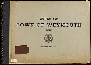
Atlas of Town of Weymouth, Massachusetts
88.
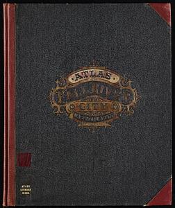
Atlas of Fall River City, Massachusetts
89.
Contents of composite atlas volume 2
90.
Atlas of Haverhill and Bradford, Massachusetts
91.
Atlas of New Bedford city, Massachusetts
92.
City of Waltham, Massachusetts [assessors atlas]
93.
Robinson's atlas of Norfolk County, Massachusetts : compiled from official records, private plans & actual surveys
94.
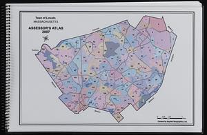
Town of Lincoln, Massachusetts assessor's atlas
95.
Town of Norton, Massachusetts [property atlas]
96.
Atlas of Fall River City, Massachusetts
97.
Atlas of the town of Wayland
98.
Atlas of town of Weymouth Massachusetts
99.
Atlas of town of Weymouth Massachusetts
100.
Atlas of town of Weymouth Massachusetts
‹ Prev
Next ›
1
2
3
4
5
6
7
8
9
…
143
144


![City of Waltham, Massachusetts [assessors atlas]](https://bpldcassets.blob.core.windows.net/derivatives/images/commonwealth:cj82r8418/image_thumbnail_300.jpg)

![Town of Norton, Massachusetts [property atlas]](https://bpldcassets.blob.core.windows.net/derivatives/images/commonwealth:3x81cp972/image_thumbnail_300.jpg)


