Toggle navigation
LMEC Home
Exhibitions
Georeferencing
Tools for Teachers
Collections
My Favorites
Sign Up / Log In
Search
Search the map portal
Map Collection
Map Collection
Map Sets
Search
Search
Search for
Search In
All Fields
Creator
Title
Subject
Place
Search All Digital Collections
Advanced Search
13645 Results
Filter your Search
Place
North and Central America
10,311
United States
8,442
Massachusetts
2,784
Suffolk (county)
1,677
Boston
1,633
Europe
1,413
Canada
950
New York
648
more
Place
»
Topic
Boston (Mass.)--Maps
747
City planning--Massachusetts--Boston--Maps
418
United States--History--Revolution, 1775-1783--Maps
329
United States--Maps
321
Real property--Massachusetts--Boston--Maps
254
Urban renewal--Massachusetts--Boston--Maps
254
Massachusetts--Maps
231
Insurance surveys
197
more
Topic
»
Date
Date range begin
–
Date range end
Current results range from
1482
to
2023
View distribution
Creator
United States. Hydrographic Office
597
Boston Redevelopment Authority
404
Des Barres, Joseph F. W. (Joseph Frederick Wallet), 1722-1824
247
Royal United Services Institute for Defence and Security Studies
160
Jefferys, Thomas, -1771
154
George, III, King of Great Britain, 1738-1820
152
George, IV, King of Great Britain, 1762-1830
151
O.H. Bailey & Co
148
more
Creator
»
Format
Maps/Atlases
13,464
Manuscripts
985
Prints
102
Books
49
Drawings/Illustrations
44
Photographs
15
Objects/Artifacts
13
Documents
7
more
Format
»
Georeferenced
Yes
979
No
12,666
Collection
Norman B. Leventhal Map & Education Center Collection
9,088
American Revolutionary War-Era Maps
3,305
Boston and New England Maps
2,908
Urban Maps
2,465
Maritime Charts and Atlases
1,169
William L. Clements Library Collection
910
Library of Congress Collection
618
Boston Redevelopment Authority Collection
475
more
Collection
»
Available to use
No known restrictions
10,212
Creative Commons license
1,677
Search Constraints
Sort by relevance
relevance
title
date (asc)
date (desc)
Number of results to display per page
20 per page
10
per page
20
per page
50
per page
100
per page
View results as:
grid view
map view
Search Results
2961.
Diocese de Lavaur descrit par ordre de Monseigneur l'illustrissime et reverendissime Charles Le Goux de Laberchere Evesque de...
2962.
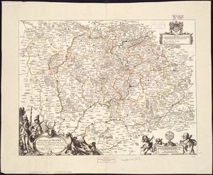
Le Diocese de Limoges : divisé en ses dix huict Archipretré et les Gouvernemens de la Marche et du Limosin dans les quels il...
2963.
Diocese de Nismes
2964.
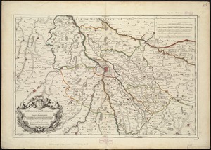
Le Diocese de Toulouse
2965.
Diocese du Mans divisee par doyennes ruraux
2966.
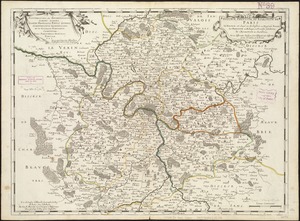
Diocese, prevoste, et eslection de Paris : le diocese est divisé en archipretrés, ou doyennés ruraux, la prevosté en...
2967.
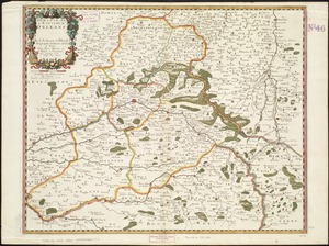
Dioecese de l'Evesché d'Orleans
2968.
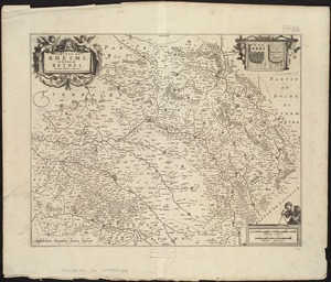
Dioecese de Rheims, et le païs de Rethel
2969.
Diqiu quan tu
2970.
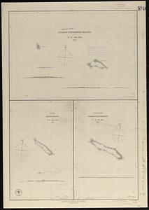
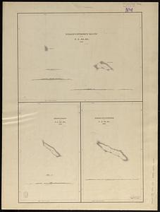
Disappointment Group ; Reao or Serle Island ; Pukaruha or Clermont-Tonnere
2971.
Disappointment Group ; Serle Island ; Clermont-Tonnere
2972.
Disconnected : Boston's free wi-fi leaves many in the dark
2973.
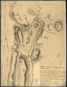
Discription [sic] of the roads about White Plains
2974.
Il disegno del discoperto della noua Franza : ilquale s'è hauuto ultimamente dalla nouissima nauigatione dè Franzesi in quel...
2975.
Disposition of British troops, with fortifications north of Fort Knipehausen, i.e. Fort Washington to Fort Independence
2976.
Disposition of the British forces before Charleston 1780
2977.
Disposition of the British forces on Long Island, Staten Island, and Manhattan Island, under Cornwallis and Knyphausen
2978.
Disposition parcel plan, central area
2979.
Disposition parcels, Charlestown urban renewal area, Massachusetts R-55
2980.
Distances North River
‹ Prev
Next ›
1
2
…
145
146
147
148
149
150
151
152
153
…
682
683


![Discription [sic] of the roads about White Plains](https://bpldcassets.blob.core.windows.net/derivatives/metadata/commonwealth-oai:w3767301r/image_thumbnail_300.jpg)