Toggle navigation
LMEC Home
Exhibitions
Georeferencing
Tools for Teachers
Collections
My Favorites
Sign Up / Log In
Search
Search the map portal
Map Collection
Map Collection
Map Sets
Search
Search
Search for
Search In
All Fields
Creator
Title
Subject
Place
Search All Digital Collections
Advanced Search
13518 Results
Filter your Search
Place
North and Central America
10,232
United States
8,367
Massachusetts
2,778
Suffolk (county)
1,675
Boston
1,631
Europe
1,386
Canada
949
New York
640
more
Place
»
Topic
Boston (Mass.)--Maps
746
City planning--Massachusetts--Boston--Maps
418
United States--History--Revolution, 1775-1783--Maps
329
United States--Maps
321
Real property--Massachusetts--Boston--Maps
254
Urban renewal--Massachusetts--Boston--Maps
254
Massachusetts--Maps
230
Insurance surveys
197
more
Topic
»
Date
Date range begin
–
Date range end
Current results range from
1482
to
2023
View distribution
Creator
United States. Hydrographic Office
596
Boston Redevelopment Authority
404
Des Barres, Joseph F. W. (Joseph Frederick Wallet), 1722-1824
247
Royal United Services Institute for Defence and Security Studies
160
Jefferys, Thomas, -1771
154
George, III, King of Great Britain, 1738-1820
152
George, IV, King of Great Britain, 1762-1830
151
O.H. Bailey & Co
148
more
Creator
»
Format
Maps/Atlases
13,337
Manuscripts
985
Prints
102
Books
49
Drawings/Illustrations
44
Photographs
15
Objects/Artifacts
13
Documents
7
more
Format
»
Georeferenced
Yes
979
No
12,539
Collection
Norman B. Leventhal Map & Education Center Collection
9,022
American Revolutionary War-Era Maps
3,305
Boston and New England Maps
2,900
Urban Maps
2,425
Maritime Charts and Atlases
1,167
William L. Clements Library Collection
910
Library of Congress Collection
618
Boston Redevelopment Authority Collection
475
more
Collection
»
Available to use
No known restrictions
10,085
Creative Commons license
1,677
Search Constraints
Sort by relevance
relevance
title
date (asc)
date (desc)
Number of results to display per page
20 per page
10
per page
20
per page
50
per page
100
per page
View results as:
grid view
map view
Search Results
5481.
Map of the canals and rail roads for transporting anthracite coal from the several coal fields to the city of New York
5482.
A map of the Cape de Verd Islands with the adjacent coast of Africa, the settlements of Senegal, Gambia and Goree, also a plan...
5483.
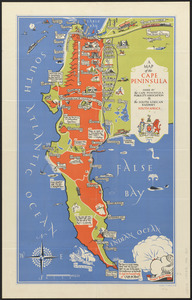
A map of the Cape Peninsula
5484.
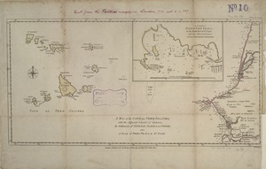
Map of the Caribbean Area
5485.
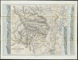
Map of the Catskill Mountains
5486.
Map of the cemetery of Mount Auburn, Boston
5487.
Map of the central business district city of Boston showing the location of underground conduits
5488.
Map of the central business district of Boston
5489.
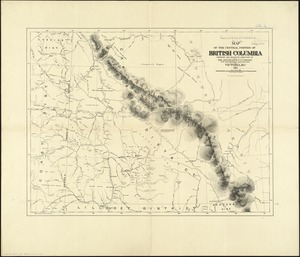
Map of the central portion of British Columbia
5490.
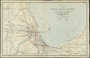
Map of the Chicago Terminal Transfer Railroad Company and connecting lines
5491.
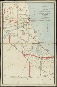
Map of the Chicago Terminal Transfer Railroad Company and connections
5492.
Map of the cities of Albany and Rensselaer and portions of Bath and East Greenbrush, New York
5493.
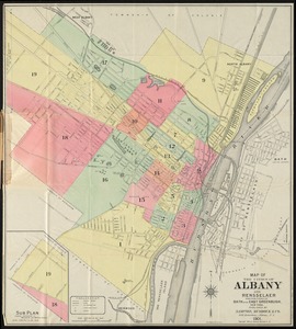
Map of the cities of Albany and Rensselaer, New York
5494.
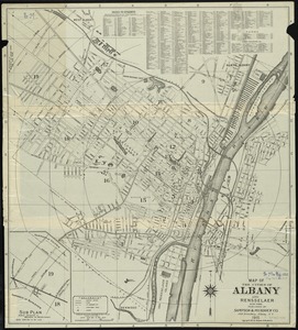
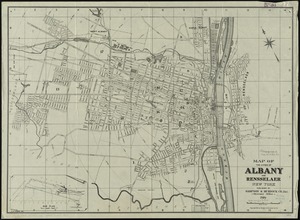
Map of the cities of Albany and Rensselaer, New York
5495.
Map of the cities of Boston, Cambridge, Somerville and Chelsea, and the town of Brookline with parts of Newton, Malden and...
5496.
Map of the cities of New York, Brooklyn & Jersey City
5497.
Map of the cities of New York, Brooklyn, Jersey City, Hudson City and Hoboken
5498.
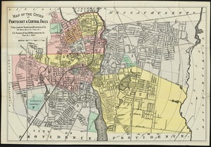
Map of the cities of Pawtucket & Central Falls
5499.
Map of the city & county of New York
5500.
Map of the city & county of New York ; Upper part of the city and county of New York on a reduced scale
‹ Prev
Next ›
1
2
…
271
272
273
274
275
276
277
278
279
…
675
676