Toggle navigation
LMEC Home
Exhibitions
Georeferencing
Tools for Teachers
Collections
My Favorites
Sign Up / Log In
Search
Search the map portal
Map Collection
Map Collection
Map Sets
Search
Search
Search for
Search In
All Fields
Creator
Title
Subject
Place
Search All Digital Collections
Advanced Search
10713 Results
My Search
Start Over
All Fields
americas
Remove constraint All Fields: americas
Filter your Search
Place
North and Central America
10,111
United States
8,243
Massachusetts
2,691
Suffolk (county)
1,662
Boston
1,619
Canada
936
New York
640
Middlesex (county)
424
more
Place
»
Topic
Boston (Mass.)--Maps
740
City planning--Massachusetts--Boston--Maps
418
United States--History--Revolution, 1775-1783--Maps
327
United States--Maps
313
Urban renewal--Massachusetts--Boston--Maps
254
Real property--Massachusetts--Boston--Maps
252
Massachusetts--Maps
219
Insurance surveys
194
more
Topic
»
Date
Date range begin
–
Date range end
Current results range from
1507
to
2023
View distribution
Creator
Boston Redevelopment Authority
403
United States. Hydrographic Office
365
Des Barres, Joseph F. W. (Joseph Frederick Wallet), 1722-1824
197
Jefferys, Thomas, -1771
150
George, III, King of Great Britain, 1738-1820
146
O.H. Bailey & Co
146
George, IV, King of Great Britain, 1762-1830
145
Royal United Services Institute for Defence and Security Studies
139
more
Creator
»
Format
Maps/Atlases
10,590
Manuscripts
916
Prints
60
Books
43
Drawings/Illustrations
43
Photographs
15
Objects/Artifacts
7
Posters
3
more
Format
»
Georeferenced
Yes
823
No
9,890
Collection
Norman B. Leventhal Map & Education Center Collection
6,479
American Revolutionary War-Era Maps
3,123
Boston and New England Maps
2,801
Urban Maps
2,249
William L. Clements Library Collection
892
Maritime Charts and Atlases
802
Library of Congress Collection
552
Boston Redevelopment Authority Collection
475
more
Collection
»
Available to use
No known restrictions
7,530
Creative Commons license
1,540
Search Constraints
Sort by relevance
relevance
title
date (asc)
date (desc)
Number of results to display per page
20 per page
10
per page
20
per page
50
per page
100
per page
View results as:
grid view
map view
Search Results
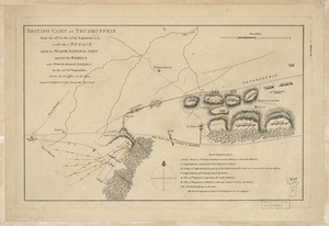
1721.
British camp at Trudruffrin from the 18th. to the 21st. of September 1777 : with the attack made by Major General Grey against...
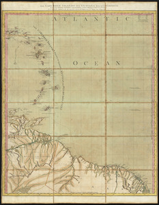
1722.
The Caribbee Islands and Guayana
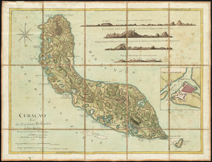
1723.
Curaçao : tiré des originaux Hollandois de Van Keulen ; dressé sur les dernieres observations
1724.
Curious enigmatical epitaphs
1725.
Done by order of His excellency Montagu Wilmot, Esq. Governor and Commander in Chief of Nova Scotia, &c., &., &
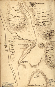
1726.
Fort Washington & vicinity
1727.
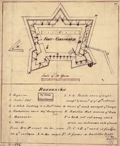
Fort-Griswold
1728.
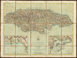
La Jamaique
1729.
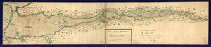
Lake Champlain and Lake George, and the country between the Hudson and the lakes on the west, and Connecticut River on the east
1730.
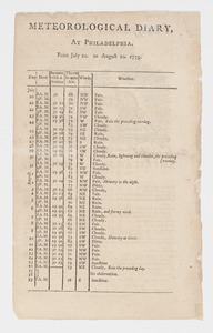
Meteorological diary, at Philadelphia, from July 20, to August 20, 1775
1731.
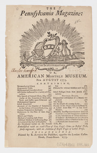
The Pennsylvania Magazine: or, American Monthly Museum : for August 1775 : [table of contents]
1732.
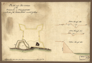
Plan and sections of the redoubt at Billingsfort and plan of the rebel fort marked yellow
1733.
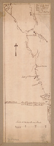
A plan of a survey made to explore the country for a road between Connecticut River & St. Francis
1734.
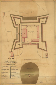
A plan of Fort George at the city of New-York
1735.
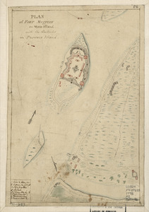
Plan of Fort Mifflin on Mud Island, with the batteries on Province Island
1736.
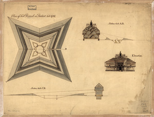
Plan of Fort Pownal at Penobscot built 1759
1737.
A plan of the attacks against Fort Miflin on Mud Island : which surrendered 16th, November 1777 to the Kings troops under the...
1738.
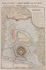
Plan of the post at Great Bridge, on the south branch of the Elizabeth River, Virginia : establish'd the 5th February 1781
1739.
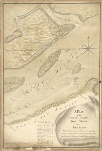
Plan of the river of Annapolis Royal in Nova Scotia
1740.
Plan of the route from St. Francis to Connecticut River
‹ Prev
Next ›
1
2
…
83
84
85
86
87
88
89
90
91
…
535
536