Toggle navigation
LMEC Home
Exhibitions
Georeferencing
Tools for Teachers
Collections
My Favorites
Sign Up / Log In
Search
Search the map portal
Map Collection
Map Collection
Map Sets
Search
Search
Search for
Search In
All Fields
Creator
Title
Subject
Place
Search All Digital Collections
Advanced Search
106 Results
My Search
Start Over
Date
1650
to
1659
Remove constraint Date: <span class='from'>1650</span> to <span class='to'>1659</span>
Filter your Search
Place
Europe
49
England
29
North and Central America
28
South America
21
France
13
United States
11
Asia
7
Mesoamerica
7
more
Place
»
Topic
America--Maps--Early works to 1800
7
Venezuela--Maps--Early works to 1800
5
Middle Atlantic States--Maps--Early works to 1800
4
New England--Maps--Early works to 1800
4
Virginia--Maps--Early works to 1800
4
Western Hemisphere--Maps--Early works to 1800
4
Asia--Maps--Early works to 1800
3
Brazil--Maps--Early works to 1800
3
more
Topic
»
Date
1650
to
1659
[remove]
106
Date range begin
–
Date range end
Current results range from
1600
to
1699
1650
to
1650
63
1651
to
1651
43
1652
to
1652
43
1653
to
1653
44
1654
to
1654
43
1655
to
1655
49
1656
to
1656
61
1657
to
1657
46
1658
to
1658
48
1659
to
1659
48
Creator
Jansson, Jan, 1588-1664
38
Blaeu, Willem Janszoon, 1571-1638
20
Sanson, Nicolas, 1600-1667
20
Walton, Robert, 1618-1688
5
Blaeu, Joan, 1596-1673
3
Danckerts, Justus, 1635-1701
2
Visscher, Nicolaes, 1618-1679
2
Allard, Huych, 1625-1691
1
more
Creator
»
Format
Maps/Atlases
106
Georeferenced
Yes
1
No
105
Collection
Norman B. Leventhal Map & Education Center Collection
103
Mapping Boston Collection
5
Maritime Charts and Atlases
1
Pechter Family Map Collection at Phillips Academy
1
Ralph Finos Map Collection at Phillips Academy
1
Robert E. Diefenbach Map Collection at Phillips Academy
1
Available to use
No known restrictions
101
Creative Commons license
5
Search Constraints
Sort by date (desc)
relevance
title
date (asc)
date (desc)
Number of results to display per page
20 per page
10
per page
20
per page
50
per page
100
per page
View results as:
grid view
map view
Search Results
1.
Americae sive Indiae Occidentalis : tabula generalis
2.
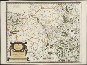
Lugdunensis Prima, cujus metropolis Lugdunum Segusianorum : Province de Lyon ou sont les dioeceses de l'Archevesche de Lyon, et...
3.
Macedonia, Epirus et Achaia
4.
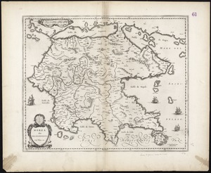
Morea olim Peloponnesus
5.
Segusiani : partie du dioecese et archevesche de Lyon : Le Bas Forez et Beaujolois : eslectons de Roanne et de Villefranche
6.
West-Indische paskaert : waer in de graden der breedde over weder zyden vande middellyn wassende soo vergroten dat die...
7.
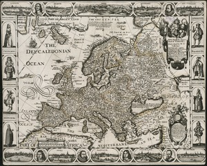
A new, plaine & exact map of Europe : described by N.I. Visscher and done into English, enlarged & corrected according to I....
8.
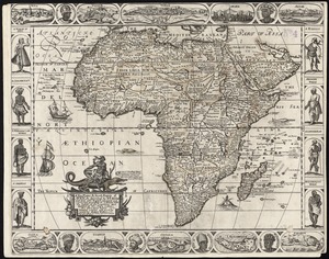
A new, plaine, & exact mapp of Africa : described by N.I. Visscher and done into English, enlarged and corrected, according to...
9.
A new, plaine, and exact map of America : described by N.I. Visscher, and don into English, enlarged, and corrected, according...
10.
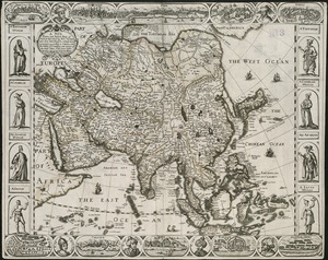
A new, plaine, and exact map of Asia : described by N.I. Visscher, and done into English, enlarged, and corrected, according to...
11.
Noua orbis terrarum delineatio singulari ratione accommodata meridiano tabb. Rudolphi astronomicarum
12.
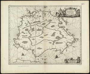
Insula Borneo et occidentalis pars Celebris, cum adjacentibus insulis
13.
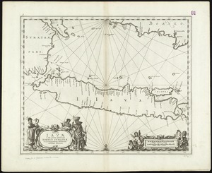
Insulae Iavae, cum parte insularum Borneo Sumatrae, et circumjacentum insularum novissima delineatio
14.
A plat of all the world : projected according to the truest rules being far more exact than either the plain-card or the maps...
15.
Atrebates : Evesché d'Arras comté d'Artois subdivisé en toutes ses Iurisdictions scav. gouvernance d'Arras, com.te de St Pol...
16.
Le Canada, ou Nouvelle France, &c : ce qui est le plus advance vers le Septentrion est tiré de diverses relations des Anglois,...
17.
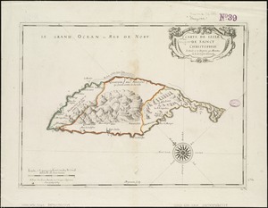
Carte de lisle de Sainct Christophle : scituée a 17 degrez 30 minutes de lat. septentrionale
18.
Catalauni : evesché de Chalons sur Marne, et en Champagne
19.
Le Chili
20.
Isle de la Guadeloupe
‹ Prev
Next ›
1
2
3
4
5
6