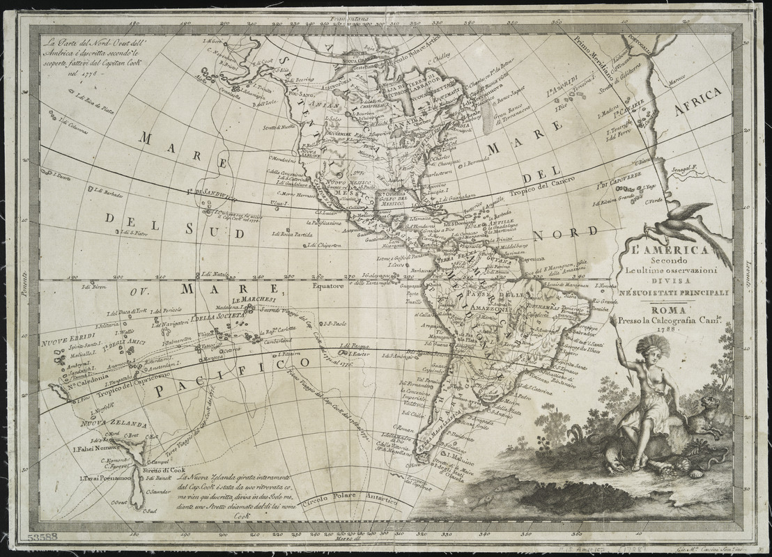
L'America secondo leultime osservazioni divisa né suoistati principali
This map is also available in American Revolutionary Geographies Online (ARGO), a collections portal especially built for material relating to the American Revolutionary War Era. Visit ARGO to learn more about this item and explore the historical geography of North America in the late eighteenth century.
Item Information
- Title:
- L'America secondo leultime osservazioni divisa né suoistati principali
- Creator:
- Cassini, Giovanni Maria, active 1788-1815
- Name on Item:
-
Gio. Ma. Cassini Somo. inc.
- Date:
-
1788
- Format:
-
Maps/Atlases
- Location:
- New York Public Library
- Collection (local):
-
Maps of North and South America
- Subjects:
-
Western Hemisphere--Maps--Early works to 1800
- Places:
-
North America (area)
South America
Mesoamerica (area)
- Extent:
- 1 map ; 31 x 44 cm
- Terms of Use:
-
No known copyright restrictions.
This work is licensed for use under a Creative Commons Attribution Non-Commercial Share Alike License (CC BY-NC-SA).

- Publisher:
-
Roma :
Presso la Calcografia Camle
- Scale:
-
Scale [ca. 1:55,000,000]
- Language:
-
Italian
- Catalog Record:
-
https://digitalcollections.nypl.org/items/510d47db-b01e-a3d9-e040-e00a18064a99
- Notes:
-
Relief shown by hachures.
Prime meridian: Ferro.
Decorative scene of Indian holding an arrow with two New World animals.


