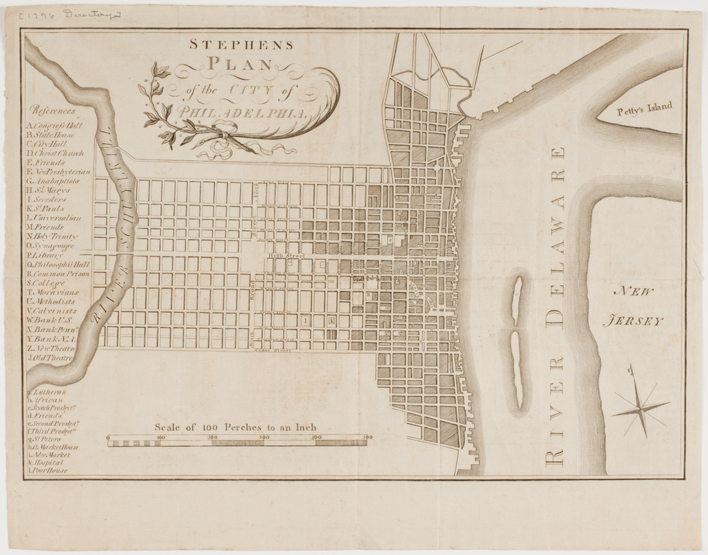
Stephens plan of the city of Philadelphia
This map is also available in American Revolutionary Geographies Online (ARGO), a collections portal especially built for material relating to the American Revolutionary War Era. Visit ARGO to learn more about this item and explore the historical geography of North America in the late eighteenth century.
Item Information
- Title:
- Stephens plan of the city of Philadelphia
- Description:
-
Subject: Plan of the city of Philadelphia showing some streets named, and buildings labeled. The Delaware River and New Jersey are shown at right.
- Publisher:
- Stephens, Thomas
- Date:
-
[1796]
- Format:
-
Maps/Atlases
- Location:
- American Antiquarian Society
- Collection (local):
-
American Antiquarian Society Collection
- Subjects:
-
Philadelphia (Pa.)--Maps
- Places:
-
Philadelphia (county)Philadelphia
- Extent:
- 1 map : engraving ; 25 x 36 cm., on sheet 30 x 38 cm.
- Terms of Use:
-
Public Domain/No known restrictions on use. Contact host institution to download image.
Contact host institution for more information.
- Publisher:
-
Philadelphia :
Thomas Stephens
- Scale:
-
Scale indeterminable
- Language:
-
English
- Catalog Record:
-
http://catalog.mwa.org/vwebv/holdingsInfo?bibId=476663
- Notes:
-
From Stephens, T. Stephens's Philadelphia directory, for 1796.
State II.
"References."
- Notes (date):
-
This date is inferred.