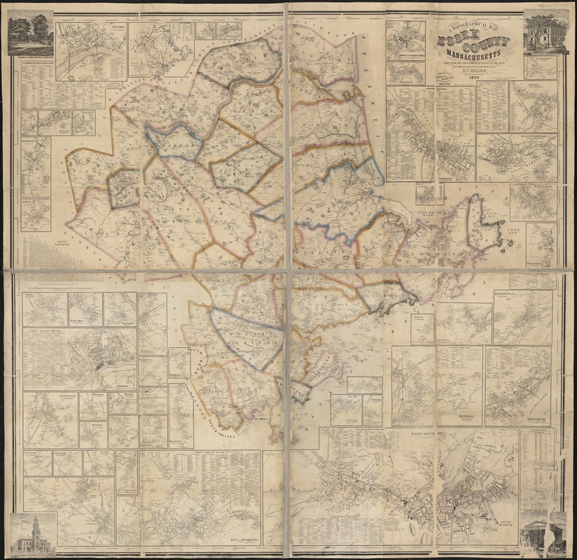
A topographical map of Essex County, Massachusetts : based upon the trigonometrical survey of the state
Item Information
- Title:
- A topographical map of Essex County, Massachusetts : based upon the trigonometrical survey of the state
- Creator:
- Walling, Henry Francis, 1825-1888
- Name on Item:
-
the details from actual surveys under the direction of H.F. Walling ; engd. by Geo. Worley & Wm. Bracher.
- Date:
-
1856
- Format:
-
Maps/Atlases
- Location:
-
Boston Public Library
Norman B. Leventhal Map & Education Center - Collection (local):
-
Norman B. Leventhal Map & Education Center Collection
- Subjects:
-
Essex County (Mass.)--Maps
- Places:
-
MassachusettsEssex (county)
- Extent:
- 1 map : col. ; 152 x 157 cm.
- Terms of Use:
-
No known copyright restrictions.
No known restrictions on use.
- Publisher:
-
Boston :
Smith and Morley
- Scale:
-
Scale ca. 1:88,700.
- Language:
-
English
- Notes:
-
Includes inset maps of Essex County communities, business directories and illustrations of points of interest.
- Identifier:
-
06_01_000895
- Call #:
-
G3763.E7 1856 .W35
- Barcode:
-
39999058989052


