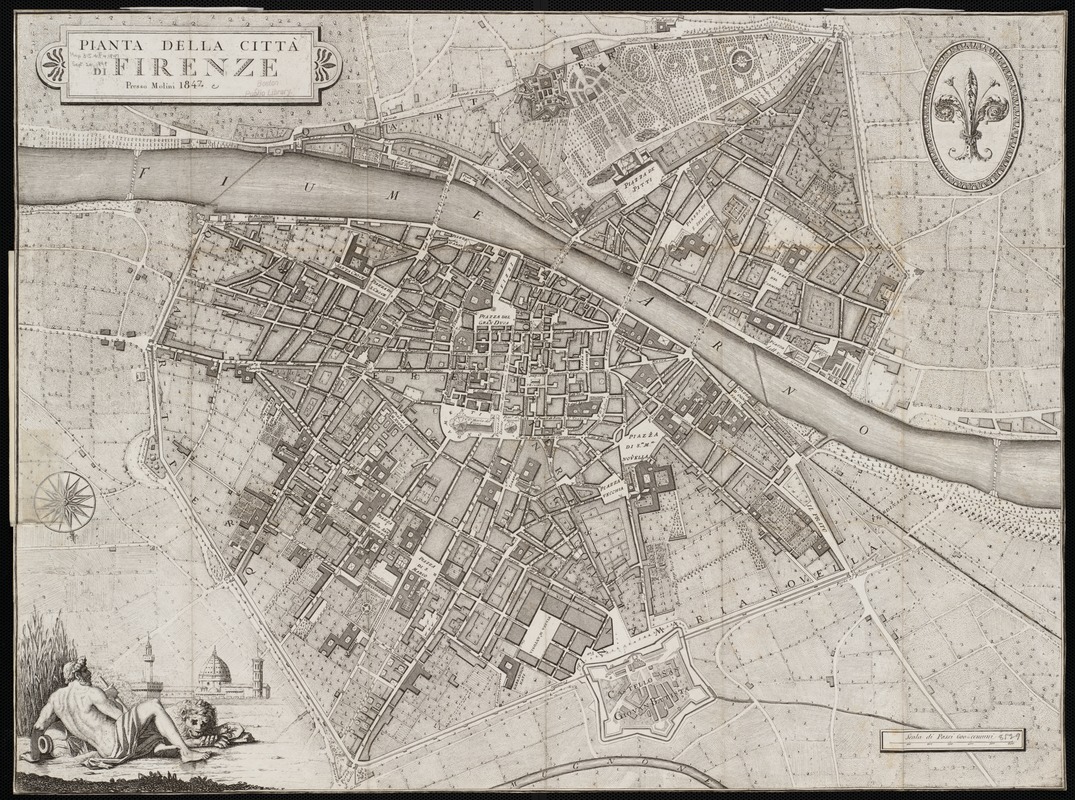
Pianta della città di Firenze
Item Information
- Title:
- Pianta della città di Firenze
- Description:
-
The mid-19th century was a time of immense change in Florence and throughout Tuscany. This map was produced at the very end of the reign of the Dukes of Tuscany over the city of Florence. The splendor of the duchy is much in evidence here -- from the huge palace and extensive gardens of the Pitti Palace in the north to the imposing fortress of the Castello San Giovan Battista at the south. It was, in part, this very splendor and extravagance that inspired the brief popular revolution in 1849 in the wake of similar uprisings in France. Although many of the streets on this map are still found in today's Florence, the modern city extends far beyond the boundaries outlined here.
- Creator:
- Molini, Giuseppe, 1772-1856
- Name on Item:
-
Giuseppe Molini.
- Date:
-
1847
- Format:
-
Maps/Atlases
- Location:
-
Boston Public Library
Norman B. Leventhal Map & Education Center - Collection (local):
-
Norman B. Leventhal Map & Education Center Collection
- Subjects:
-
Metropolitan areas--Italy--Florence
Florence (Italy)--Maps
- Places:
-
ItalyTuscany (region)Firenze (province)Florence
- Extent:
- 1 map ; 53 x 70 cm.
- Terms of Use:
-
No known copyright restrictions.
No known restrictions on use.
- Publisher:
-
Firenze :
[s.n.]
- Scale:
-
Scale not given.
- Language:
-
Italian
- Notes:
-
Relief shown by hachures.
Oriented with north towards the bottom right.
Exhibited in “Faces and Places,” at the Boston Public Library, Boston, MA, October 2003 - September 2004. MB (BRL)
- Identifier:
-
06_01_000073
- Call #:
-
G6714.F5 1847 .M6
- Barcode:
-
39999052507710