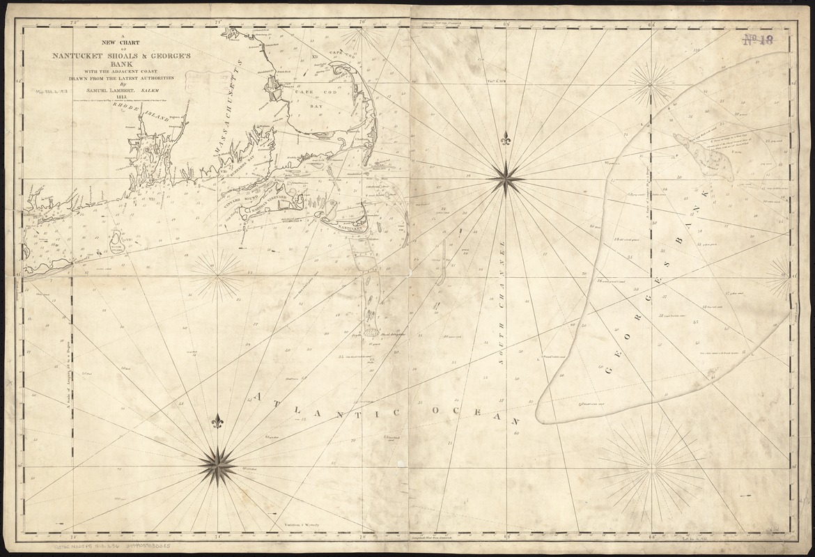
A new chart of Nantucket Shoals & George's Bank with the adjacent coast
Item Information
- Title:
- A new chart of Nantucket Shoals & George's Bank with the adjacent coast
- Creator:
- Lambert, Samuel, 1768-1832
- Name on Item:
-
drawn from the latest authorities by Samuel Lambert, Salem, 1813.
- Date:
-
[1813]
- Format:
-
Maps/Atlases
- Location:
-
Boston Public Library
Norman B. Leventhal Map & Education Center - Collection (local):
-
Norman B. Leventhal Map & Education Center Collection
- Subjects:
-
Nautical charts--Massachusetts--Nantucket Shoals
Nautical charts--Georges Bank
Nantucket Shoals (Mass.)--Maps
Georges Bank--Maps
- Places:
-
MassachusettsNantucket (county)Nantucket Shoals (area)
MassachusettsGeorges Bank (area)
- Extent:
- 1 map ; 61 x 93 cm.
- Terms of Use:
-
No known copyright restrictions.
No known restrictions on use.
- Publisher:
-
Salem, [Mass.] :
Samuel Lambert
- Scale:
-
Scale [ca. 1:490,000]
- Language:
-
English
- Notes:
-
Relief shown by soundings.
Includes navigational notes.
Cataloging, conservation, and digitization made possible in part by The National Endowment for the Humanities: Exploring the human endeavor.
- Notes (date):
-
This date is inferred.
- Identifier:
-
06_01_007257
- Call #:
-
G3762.N325P5 1813 .L36
- Barcode:
-
39999059030385
- LCCN:
-
2008624040