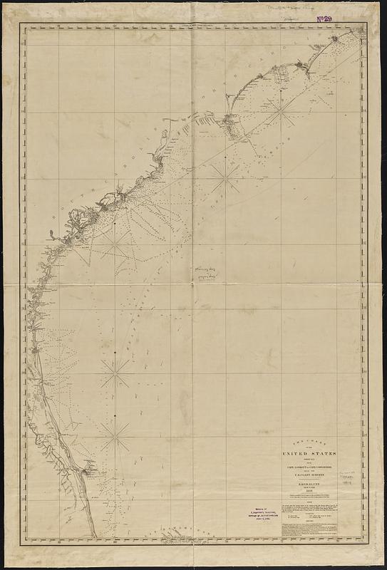
The coast of the United States, sheet no. 2 from Cape Lookout to Cape Carnaveral, from the U.S. coast surveys
Item Information
- Title:
- The coast of the United States, sheet no. 2 from Cape Lookout to Cape Carnaveral, from the U.S. coast surveys
- Publisher:
- E. & G.W. Blunt (Firm)
- Date:
-
1858
- Format:
-
Maps/Atlases
- Location:
-
Boston Public Library
Norman B. Leventhal Map & Education Center - Collection (local):
-
Norman B. Leventhal Map & Education Center Collection
- Subjects:
-
South Atlantic States--Maps
Atlantic Coast (South Atlantic States)--Maps
Nautical charts--South Atlantic States
- Places:
-
South Atlantic states (area)
- Extent:
- 1 map : hand colored ; 118 x 78 cm
- Terms of Use:
-
No known copyright restrictions.
No known restrictions on use.
- Publisher:
-
New York :
E. & G.W. Blunt
- Scale:
-
Scale approximately 1:780,000
- Language:
-
English
- Notes:
-
Depths shown in soundings and gradient tints.
- Identifier:
-
06_01_017461
- Call #:
-
G3872.C6P5 1858 .E24
- Barcode:
-
39999085966040