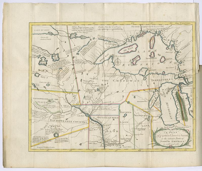
A plan of Captain Carvers travels in the interior parts of North America in 1776 and 1767
This map is also available in American Revolutionary Geographies Online (ARGO), a collections portal especially built for material relating to the American Revolutionary War Era. Visit ARGO to learn more about this item and explore the historical geography of North America in the late eighteenth century.
Item Information
- Title:
- A plan of Captain Carvers travels in the interior parts of North America in 1776 and 1767
- Contributor:
- Carver, Jonathan, 1710-1780
- Date:
-
1781
- Format:
-
Maps/Atlases
- Location:
- MacLean Collection Map Library
- Collection (local):
-
MacLean Collection Map Library
- Subjects:
-
Wisconsin--Maps--Early works to 1800
Michigan--Maps--Early works to 1800
Indians of North America--Maps
- Places:
-
Wisconsin
Michigan
- Extent:
- 2 maps ; 349 x 438 mm and 337 x 413 mm
- Terms of Use:
-
Public Domain/No known restrictions on use. Contact host institution to download image.
Contact host institution for more information.
- Publisher:
-
London :
Dilly, Charles
- Language:
-
English
- Notes:
-
In: Travels through the interior parts of North-America, in the years 1766, 1767, 1768 / by J. Carver, esq. (London: C. Dilly, 1781).
- Identifier:
-
MC_25318_map2
- Call #:
-
25318