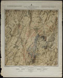
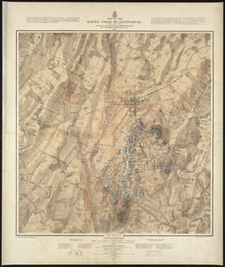
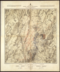
Gettysburg and vicinity : Constructed and engraved to illustrate "The war with the South"
Item Information
- Title:
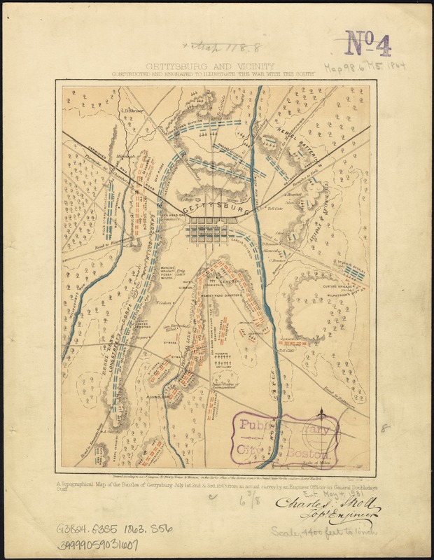
- Gettysburg and vicinity : Constructed and engraved to illustrate "The war with the South"
- Creator:
- Sholl, Charles.
- Name on Item:
-
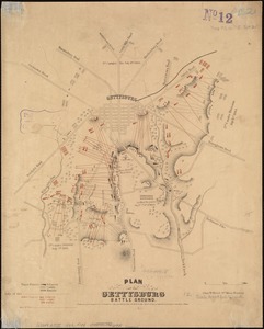
A topographical map of the battles of Gettysburg, July 1st, 2nd & 3rd, 1863, from an actual survey by an engineer officer on General Doubleday's staff.
- Date:
-
1864
- Format:
-
Maps/Atlases
- Location:
-
Boston Public Library
Norman B. Leventhal Map & Education Center - Collection (local):
-
Norman B. Leventhal Map & Education Center Collection
- Subjects:
-
Gettysburg, Battle of, Gettysburg, Pa., 1863--Maps
Gettysburg (Pa.)--History--19th century--Maps
- Places:
-
PennsylvaniaAdams (county)Gettysburg
- Extent:
- 1 map : col. ; 21 x 17 cm.
- Terms of Use:
-
No known copyright restrictions.
No known restrictions on use.
- Publisher:
-
[New York] :
Virtue, Yorston & Co.
- Scale:
-
Scale ca. 1:53,000.
- Language:
-
English
- Notes:
-
From Tomes, Robert. The War with the South. New York, Virtue & Yorston, 1862-1867. v. 3, between p. 156 and 157.
Signed (facsim.): Charles: Sholl, Topl. Engineer.
Indicates Union positions in red, Confederate positions in blue, artillery positions, roads, railroad, vegetation, and streams.
Description derived from published bibliography.
- Identifier:
-
06_01_007458
- Call #:
-
G3824.G3S5 1863 .S56
- Barcode:
-
39999059031607
- LCCN:
-
99439168