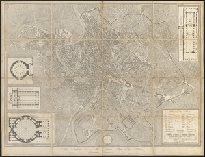
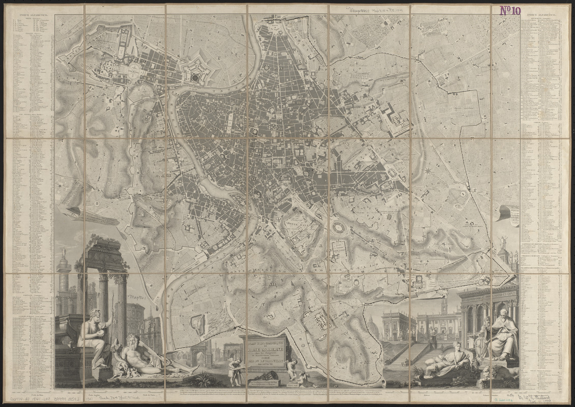
Plan topographique de Rome moderne : avec les changemens et accroissemens nouveaux
Item Information
- Title:
- Plan topographique de Rome moderne : avec les changemens et accroissemens nouveaux
- Cartographer:
- Letarouilly, Paul Marie, 1795-1855
- Publisher:
- Letarouilly, Paul Marie, 1795-1855
- Engraver:
- Blanchard, Auguste, 1818-1898
- Engraver:
- Delsol, Théodore, 1819-
- Engraver:
- Hacq, J. M.
- Engraver:
- Lepetit, Huguenet
- Engraver:
- Rouillard
- Engraver:
- Roulier, P.
- Name on Item:
-
la topographie gravée par Delsol, les eaux par Rouillard et les figures par Blanchard ; l'architecture gravée par Huguenet Lepetit, le plan par P. Roulier et la lettre par Hacq.
- Date:
-
1841
- Format:
-
Maps/Atlases
- Location:
-
Boston Public Library
Norman B. Leventhal Map & Education Center - Collection (local):
-
Norman B. Leventhal Map & Education Center Collection
- Subjects:
-
Rome (Italy)--Maps
- Places:
-
ItalyLatian (region)Roma (province)Rome
- Extent:
- 1 map ; 54 x 66 cm
- Terms of Use:
-
No known copyright restrictions.
No known restrictions on use.
- Publisher:
-
Paris :
Pl. Letarouilly
- Scale:
-
Scale approximately 1:8,750
- Language:
-
French
- Notes:
-
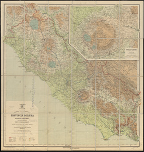
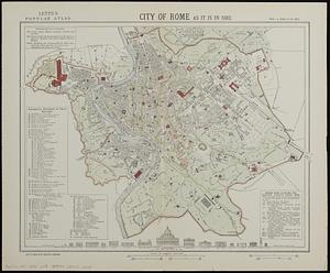
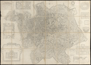
Relief shown by hachures.
Includes illustrations of ancient and Renaissance Rome, probably by Auguste Blanchard (1818-1898).
Includes index to left and right of map.
Map of Environs de Rome pasted on verso, 11 x 18 cm. In lower left: Carte à joindre au Plan de Rome de Pl. Letarouilly.
- Identifier:
-
06_01_015113
- Call #:
-
G6714.R7 1841 .L48
- Barcode:
-
39999085931341