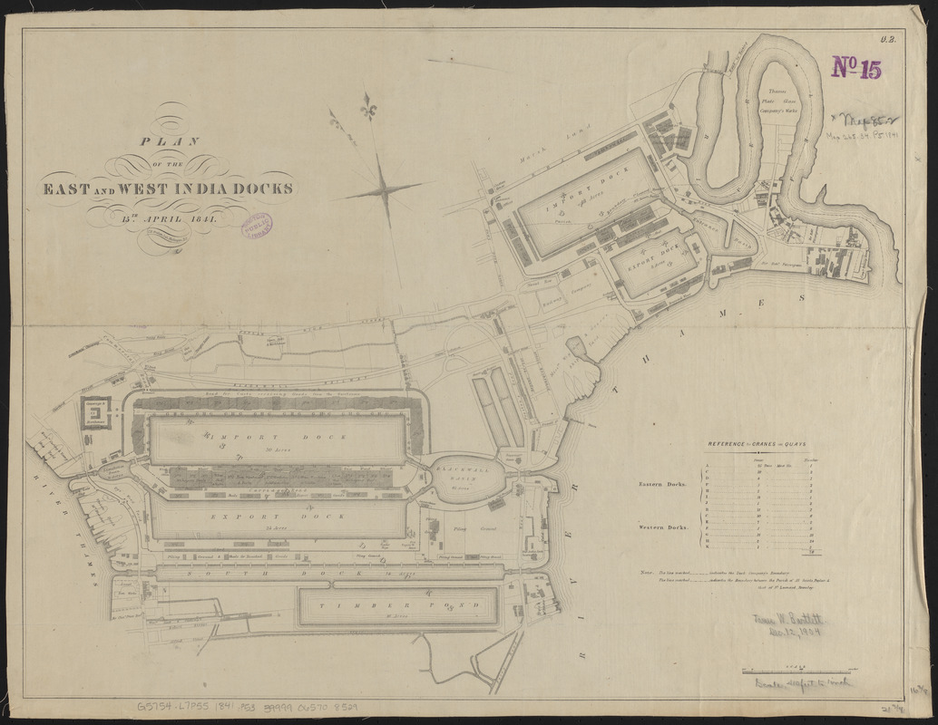
Plan of the East and West India Docks, 15th April 1841
Item Information
- Title:
- Plan of the East and West India Docks, 15th April 1841
- Lithographer:
- Graham, C. B. (Curtis B.)
- Date:
-
1841
- Format:
-
Maps/Atlases
- Location:
-
Boston Public Library
Norman B. Leventhal Map & Education Center - Collection (local):
-
Norman B. Leventhal Map & Education Center Collection
- Subjects:
-
Docks--England--London--Maps
London (England)--Maps
- Places:
-
EnglandLondon
- Extent:
- 1 map ; 42 x 55 cm
- Terms of Use:
-
No known copyright restrictions.
No known restrictions on use.
- Publisher:
-
Washington, D.C. :
C.B. Graham lith.
- Scale:
-
Scale approximately 1:4,900
- Language:
-
English
- Notes:
-
Oriented with north towards the upper left.
Includes references to cranes on quays.
- Identifier:
-
06_01_014916
- Call #:
-
G5754.L7P55 1841 .P53
- Barcode:
-
39999065708529


