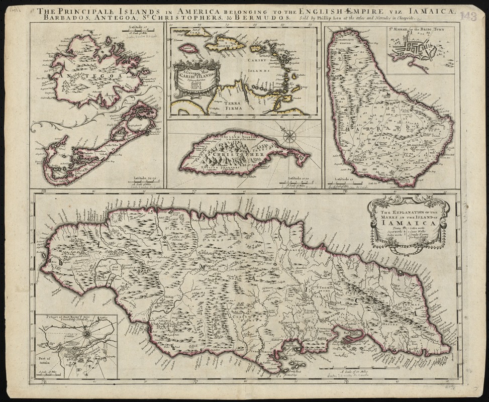
The principall islands in America belonging to the English empire viz Iamaica, Barbados, Antegoa, St. Christophers & Bermudos
Item Information
- Title:
- The principall islands in America belonging to the English empire viz Iamaica, Barbados, Antegoa, St. Christophers & Bermudos
- Title (alt.):
-
Principal islands in America belonging to the English empire viz Jamaica, Barbados, Antegoa, St. Christophers & Bermudos
Collection of old maps
- Creator:
- Lea, Philip, fl. 1683-1700
- Date:
-
[1696]
- Format:
-
Maps/Atlases
- Location:
-
Boston Public Library
Norman B. Leventhal Map & Education Center - Collection (local):
-
Norman B. Leventhal Map & Education Center Collection
- Subjects:
-
West Indies--Maps--Early works to 1800
Jamaica--Maps--Early works to 1800
Saint Kitts--Maps--Early works to 1800
Antigua and Barbuda--Maps--Early works to 1800
Barbados--Maps--Early works to 1800
- Places:
-
Antigua and Barbuda
Barbados
Jamaica
Saint Kitts and NevisSaint Kitts (island)
West Indies
- Extent:
- 5 maps on 1 sheet : hand col. ; on sheet 52 x 63 cm.
- Terms of Use:
-
No known copyright restrictions.
No known restrictions on use.
- Publisher:
-
[London] :
Sold by Phillip Lea at the Atlas and Hercules in Cheapside
- Scale:
-
Scales differ.
- Language:
-
English
- Table of Contents:
-
[Antigua and Bermuda Islands]
A general map of the Cariby Islands
[Saint Kitts]
[Barbados]
The explanation of the marks on the island of Iamaica.
- Notes:
-
Relief shown pictorially.
Bar scale given in miles.
Cataloging, conservation, and digitization made possible in part by The National Endowment for the Humanities: Exploring the human endeavor.
Part of composite portfolio atlas with title "Collection of old maps."
- Notes (date):
-
This date is inferred.
- Identifier:
-
06_01_010217
- Call #:
-
G1015 .C651 1630
- Barcode:
-
30000003238113


