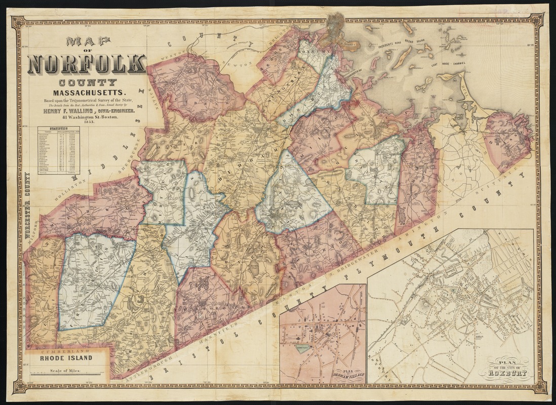
Map of Norfolk County, Massachusetts : based upon the trigonometrical survey of the state
Item Information
- Title:
- Map of Norfolk County, Massachusetts : based upon the trigonometrical survey of the state
- Creator:
- Walling, Henry Francis, 1825-1888
- Name on Item:
-
the details from the best authorities and from actual survey by Henry F. Walling.
- Date:
-
1853
- Format:
-
Maps/Atlases
- Location:
-
Boston Public Library
Norman B. Leventhal Map & Education Center - Collection (local):
-
Norman B. Leventhal Map & Education Center Collection
- Subjects:
-
Real property--Massachusetts--Norfolk County--Maps
Norfolk County (Mass.)--Maps
- Places:
-
MassachusettsNorfolk (county)
- Extent:
- 1 map : col. ; 65 x 93 cm.
- Terms of Use:
-
No known copyright restrictions.
No known restrictions on use.
- Publisher:
-
Boston, Mass :
[H.F. Walling]
- Scale:
-
Scale [1:63,360].
- Language:
-
English
- Notes:
-
Relief shown by hachures.
Includes insets of: Roxbury, Dedham Village, statistics.
Shows buildings and householders' names.
- Identifier:
-
06_01_003249
- Call #:
-
G3763.N6 1853 .W3
- Barcode:
-
39999058999754