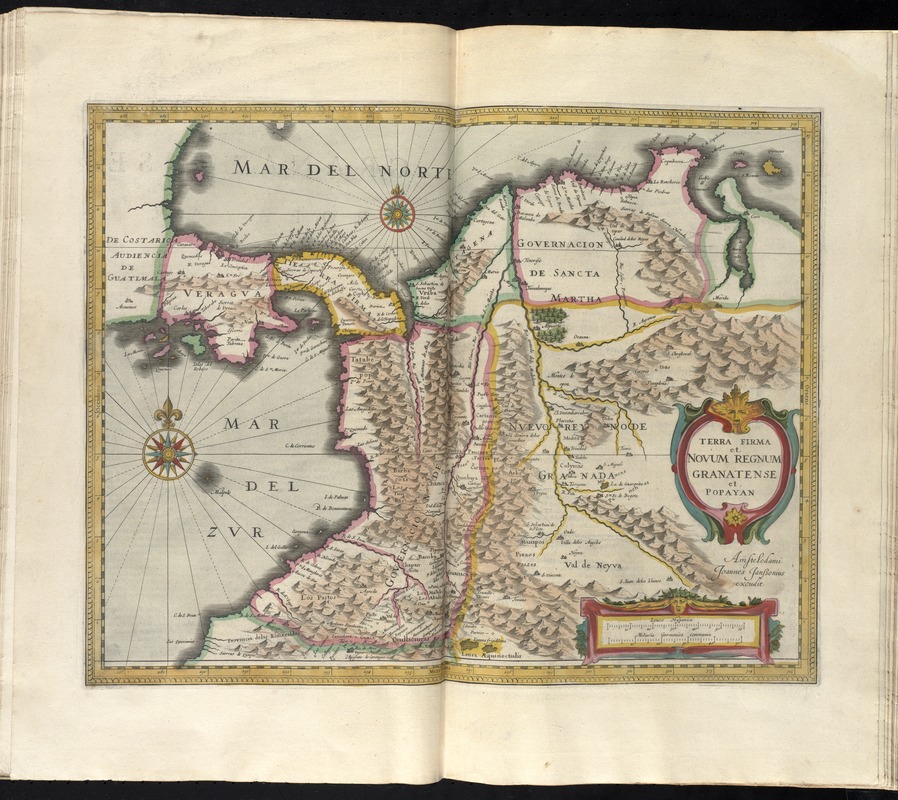
Terra firma et novum regnum Granatense et Popayan
Item Information
- Title:
- Terra firma et novum regnum Granatense et Popayan
- Creator:
- Hondius, Hendrik, 1597-1651
- Date:
-
[1638]
- Format:
-
Maps/Atlases
- Location:
-
Boston Public Library
Norman B. Leventhal Map & Education Center - Collection (local):
-
Norman B. Leventhal Map & Education Center Collection
- Subjects:
-
Colombia--Maps--Early works to 1800
Venezuela--Maps--Early works to 1800
Panama--Maps--Early works to 1800
- Places:
-
Venezuela
Panama
Colombia
- Extent:
- 1 map : hand col. ; 36 x 47 cm.
- Terms of Use:
-
No known copyright restrictions.
No known restrictions on use.
- Publisher:
-
Amstelodami :
Joannes Janssonius excudit
- Scale:
-
Scale [ca. 1:4,200,000]
- Language:
-
Latin
- Notes:
-
Relief shown pictorially.
Shows southern part Central America and northwestern part of South America.
In Latin on verso, with caption title "Terra firma novum regnum Granatense & Popayan" and signature "Xxxx."
Bar scales given in "leucae Hispanicae" and "milliaria Germanica communia."
From Jan Jansson and Henrik Hondius's Atlas novus ... Amstelodami : Apud Ionnem Ianssonium & Henricum Hondium, 1638.
Cataloging, conservation, and digitization made possible in part by The National Endowment for the Humanities: Exploring the human endeavor.
- Notes (date):
-
This date is inferred.
- Identifier:
-
06_01_008671
- Call #:
-
G1007 .A75 1638
- Barcode:
-
30000003826632