Virginia and Maryland
Item Information
- Title:
- Virginia and Maryland
- Creator:
- Moll, Herman, d. 1732
- Name on Item:
-
by H. Moll.
- Date:
-
[1732?]
- Format:
-
Maps/Atlases
- Location:
-
Boston Public Library
Norman B. Leventhal Map & Education Center - Collection (local):
-
Norman B. Leventhal Map & Education Center Collection
- Subjects:
-
Virginia--Maps--Early works to 1800
Maryland--Maps--Early works to 1800
- Places:
-
Virginia
Maryland
- Extent:
- 1 map : col. ; 26 x 19 cm.
- Terms of Use:
-
No known copyright restrictions.
No known restrictions on use.
- Publisher:
-
London :
Printed for Tho. Bowles and John Bowles
- Scale:
-
Scale [1:1,200,000].
- Language:
-
English
- Notes:
-
Imprint derived from the atlas in which the map was issued.
Numbered 50.
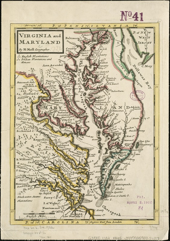
Shows rivers, boundaries, settlements and woods.
Relief shown pictorially.
London meridian.
Appears in the author's Atlas Minor. London: Thos. Bowles and John Bowles, 1732 or 1736.
Virginia and Maryland, with Chesapeake Bay.
- Identifier:
-
06_01_006286
- Call #:
-
G3880 1732 .M65
- Barcode:
-
39999059022127


