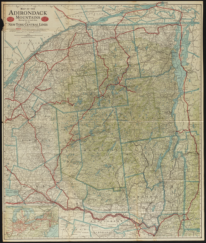
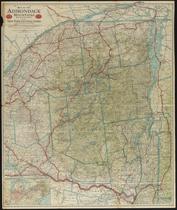
Map of the Adirondack Mountains showing how to reach them by the New York Central Lines
Item Information
- Title:
- Map of the Adirondack Mountains showing how to reach them by the New York Central Lines
- Creator:
- Rand McNally and Company
- Name on Item:
-
Rand McNally & Co.
- Date:
-
1917
- Format:
-
Maps/Atlases
- Location:
-
Phillips Academy
Archives and Special Collections - Collection (local):
-
Robert E. Diefenbach Map Collection
- Subjects:
-
Mountains
Railroad companies
New York Central Lines
- Places:
-
New YorkAdirondack Mountains
- Extent:
- 1 map : col. ; 77 x 66 cm, folded to 23 x 11 cm
- Terms of Use:
-
We believe that this item has no known US copyright restrictions. Though not required, if you want to credit us as the source, please use the following statement, "From The Trustees of Phillips Academy." Doing so helps us track how our collection is used and helps justify freely releasing even more content in the future.
This work is in the public domain under a Creative Commons No Rights Reserved License (CC0).
- Publisher:
-
Buffalo, N.Y. :
Matthews-Northrup Works
- Scale:
-
Scale 1:348,480
- Language:
-
English
- Notes:
-
Title from item.
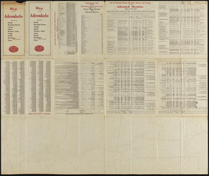
Panel title: Map of the Adirondacks and list of hotels, boarding houses, camps, stages, steamer lines, lakes, ponds, elevations above sea level fares
- Notes (date):
-
Date from item.
- Identifier:
-
2018_042