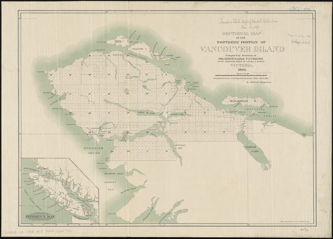
Sectional map of the northern portion of Vancouver Island
Item Information
- Title:
- Sectional map of the northern portion of Vancouver Island
- Creator:
- British Columbia. Department of Lands and Works
- Name on Item:
-
compiled by direction of the Honourable F.G. Vernon ; compiled and drawn in the Department of lands & Works, March 1893 by Gotfred Jorgensen.
- Date:
-
1893
- Format:
-
Maps/Atlases
- Location:
-
Boston Public Library
Norman B. Leventhal Map & Education Center - Collection (local):
-
Norman B. Leventhal Map & Education Center Collection
- Subjects:
-
Vancouver Island (B.C.)--Maps
- Places:
-
CanadaProvince of British Columbia (province)Vancouver Island (island)
- Extent:
- 1 map : col. ; 42 x 58 cm.
- Terms of Use:
-
No known copyright restrictions.
No known restrictions on use.
- Publisher:
-
Victoria, B.C :
Dept. of Lands and Works
- Scale:
-
Scale [ca. 1:252,000]
- Language:
-
English
- Notes:
-
Shows Cape Scott to Robson Bight, Hope Island to Cape Cook.
Inset: Reference map [Vancouver Island].
- Identifier:
-
06_01_011655
- Call #:
-
G3512.V3 1893 .B75
- Barcode:
-
39999065687541