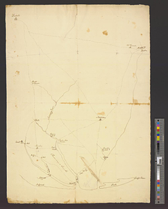
Map of Monmouth County, New Jersey

Item Information
- Title:
- Map of Monmouth County, New Jersey
- Creator:
- Beers, S. N.
- Name on Item:
-
from actual surveys by S.N. & F.W. Beers ; drawn, engraved, printed, colored & mounted at H.F. Walling's Map Establishment.
- Date:
-
1861
- Format:
-
Maps/Atlases
- Location:
-
Boston Public Library
Norman B. Leventhal Map & Education Center - Collection (local):
-
Norman B. Leventhal Map & Education Center Collection
- Subjects:
-
Real property--New Jersey--Monmouth County--Maps
Landowners--New Jersey--Monmouth County--Maps
Buildings--New Jersey--Monmouth County--Pictorial works
Monmouth County (N.J.)--Maps
- Places:
-
New JerseyMonmouth (county)
- Extent:
- 1 map : hand col. ; 151 x 147 cm.
- Terms of Use:
-
No known copyright restrictions.
No known restrictions on use.
- Publisher:
-
New York :
Smith, Gallup & Holt
- Scale:
-
Scale 1:39,600
- Language:
-
English
- Notes:
-
Relief shown by hachures.
Includes names of property owners, business directories, population table and table of distances.
Insets: Black Mills -- Middle Point -- Middletown -- Red Bank, Shewsbury -- Homdel -- Tinton Falls, Shrewsbury -- Marlboro -- Mechanicsville -- Colts Neck, Atlantic -- Fair Haven, Shrewsbury -- Shrewsbury -- Branch Port, Ocean -- Ocean Port -- Englishtown -- Squan Village, Wall -- Long Branch, Ocean -- Eatontown, Ocean -- West Freehold -- New Sharon, Upper Freehold -- Freehold -- Allentown -- Blue Ball, Howell -- Imlaystown -- Keyport.
Engravings: Congress Hall, Long Branch, N.J. -- United States Hotel, Long Branch, NJ. -- County Buildings of Monmouth Co. -- Old Tennant Church near Monmouth Battle Ground, Manalapan, N.J.
- Identifier:
-
06_01_010894
- Call #:
-
G3813.M6 1861 .B44
- Barcode:
-
39999065679712