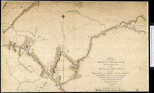
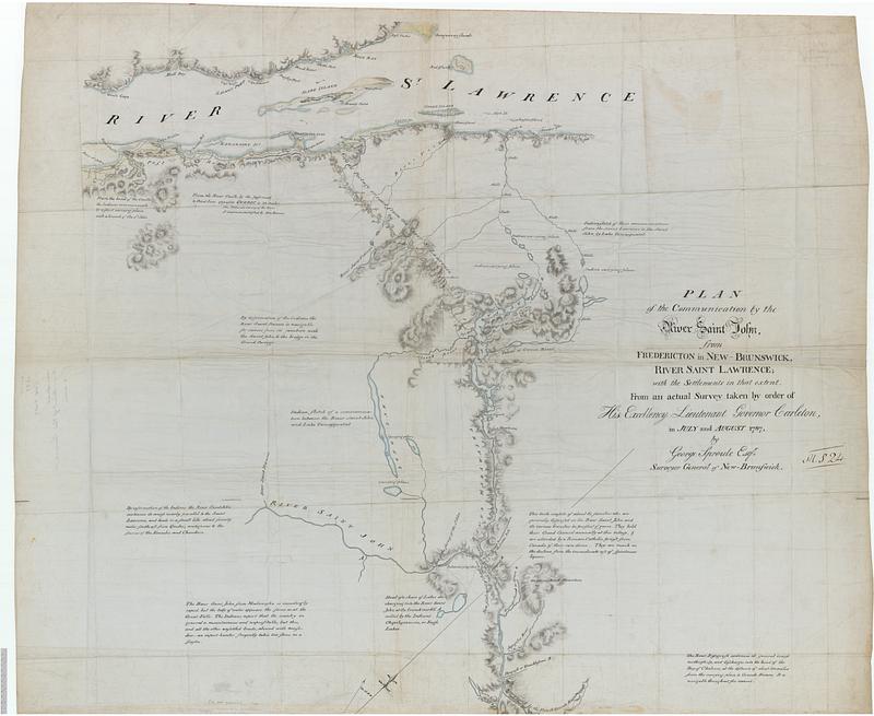
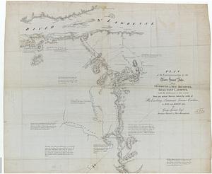
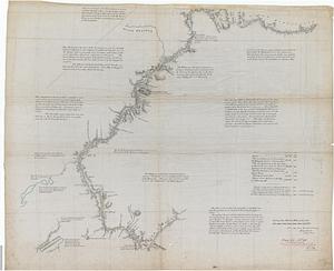
Plan of the communications by the River Saint John, from Fredericton in New Brunswick to the River Saint Lawrence : with the settlements in that extent
This map is also available in American Revolutionary Geographies Online (ARGO), a collections portal especially built for material relating to the American Revolutionary War Era. Visit ARGO to learn more about this item and explore the historical geography of North America in the late eighteenth century.
Item Information
- Title:
- Plan of the communications by the River Saint John, from Fredericton in New Brunswick to the River Saint Lawrence : with the settlements in that extent
- Cartographer:
- Sproule, Geo. F. (George F.), 1741-1817
- Name on Item:
-
from an actual survey taken by order of His Excellency Lieutenant Governor Carleton, in July and August 1787, by George Sproule Esqr. Surveyor General of New Brunswick
- Date:
-
[1787]
- Format:
-
Maps/Atlases
- Genre:
-
Manuscript maps
- Location:
- Library and Archives Canada
- Collection (local):
-
Library and Archives Canada Collection
- Subjects:
-
Saint John River (Me. and N.B.)--Maps--Early works to 1800
Wolastoqiyik Indians--New Brunswick
Portages--New Brunswick--Maps
- Places:
-
CanadaProvince of New Brunswick (province)
Saint John River
- Extent:
- 1 manuscript map : hand color ; 135 x 163 cm
- Terms of Use:
-
Copyright expired. Contact host institution to download image.
Contact host institution for more information.
- Place of origin:
-
[Fredericton]
- Language:
-
English
- Catalog Record:
-
Catalog record
- Notes (date):
-
This date is inferred.
- Identifier:
-
e010934518_a1
e010934518_b1
- Barcode:
-
4139942